This weather event on August 18, 2025 includes:
2 states
21 counties,
19 cities,
and 62 zip codes.
There were 466 total properties that were impacted and have possible damage.
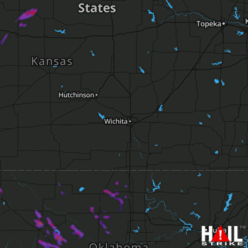 WICHITA (KICT) RADAR
States Impacted By Hail On August 18, 2025
Kansas
·
Oklahoma
Counties Impacted By Hail On August 18, 2025
Ellis, KS
·
Hodgeman, KS
·
Lyon, KS
·
Ness, KS
·
Osborne, KS
·
Rooks, KS
·
Trego, KS
·
Wabaunsee, KS
·
Alfalfa, OK
·
Blaine, OK
·
Dewey, OK
·
Ellis, OK
·
Garfield, OK
·
Grant, OK
·
Harper, OK
·
Kay, OK
·
Kingfisher, OK
·
Major, OK
·
Noble, OK
·
Woods, OK
·
Woodward, OK
Cities Impacted By Hail On August 18, 2025
Billings, OK
·
Canton, OK
·
Carrier, OK
·
Chester, OK
·
Dacoma, OK
·
Ellis, KS
·
Enid, OK
·
Fairmont, OK
·
Goltry, OK
·
Isabella, OK
·
Jefferson, OK
·
Jetmore, KS
·
Lamont, OK
·
Nardin, OK
·
Natoma, KS
·
Oakwood, OK
·
Okeene, OK
·
Taloga, OK
·
Waukomis, OK
Zip Codes Impacted By Hail On August 18, 2025
73738
·
73726
·
66423
·
66833
·
66868
·
67560
·
67572
·
67601
·
67623
·
67637
·
67651
·
67663
·
67671
·
67854
·
73056
·
73646
·
73658
·
73659
·
73663
·
73667
·
73701
·
73703
·
73705
·
73716
·
73717
·
73718
·
73720
·
73724
·
73727
·
73728
·
73729
·
73731
·
73733
·
73736
·
73737
·
73739
·
73742
·
73747
·
73754
·
73755
·
73756
·
73759
·
73763
·
73766
·
73768
·
73772
·
73773
·
73834
·
73838
·
73841
·
73848
·
73851
·
73852
·
73853
·
73860
·
74630
·
74631
·
74636
·
74640
·
74643
·
74646
·
74653

