This weather event on August 18, 2025 includes:
4 states
22 counties,
21 cities,
and 73 zip codes.
There were total properties that were impacted and have possible damage.
States Impacted By Hail On August 18, 2025
Iowa
·
Kansas
·
Missouri
·
Nebraska
Counties Impacted By Hail On August 18, 2025
Page, IA
·
Taylor, IA
·
Brown, KS
·
Chase, KS
·
Coffey, KS
·
Geary, KS
·
Lyon, KS
·
Marshall, KS
·
Morris, KS
·
Nemaha, KS
·
Pottawatomie, KS
·
Riley, KS
·
Shawnee, KS
·
Wabaunsee, KS
·
Atchison, MO
·
Audrain, MO
·
Holt, MO
·
Monroe, MO
·
Nodaway, MO
·
Ralls, MO
·
Nemaha, NE
·
Richardson, NE
Cities Impacted By Hail On August 18, 2025
Americus, KS
·
Auburn, NE
·
Blanchard, IA
·
Blanchard, MO
·
Blue Rapids, KS
·
Corning, KS
·
Council Grove, KS
·
Craig, MO
·
Elmdale, KS
·
Emporia, KS
·
Fort Riley, KS
·
Grandview Plaza, KS
·
Herington, KS
·
Junction City, KS
·
Manhattan, KS
·
Milford, KS
·
Ogden, KS
·
Olsburg, KS
·
Randolph, KS
·
Riley, KS
·
St. George, KS
Zip Codes Impacted By Hail On August 18, 2025
51631
·
51632
·
51636
·
51646
·
51647
·
63352
·
63462
·
64445
·
64446
·
64498
·
65265
·
65275
·
65282
·
65283
·
65285
·
66401
·
66402
·
66404
·
66407
·
66411
·
66415
·
66417
·
66423
·
66425
·
66428
·
66431
·
66441
·
66442
·
66449
·
66502
·
66503
·
66507
·
66508
·
66514
·
66517
·
66520
·
66521
·
66526
·
66527
·
66531
·
66535
·
66538
·
66540
·
66544
·
66547
·
66548
·
66549
·
66554
·
66610
·
66614
·
66615
·
66801
·
66830
·
66833
·
66834
·
66835
·
66838
·
66839
·
66845
·
66846
·
66849
·
66850
·
66868
·
66869
·
66872
·
66873
·
67449
·
68305
·
68320
·
68421
·
68431
·
51630
·
64437
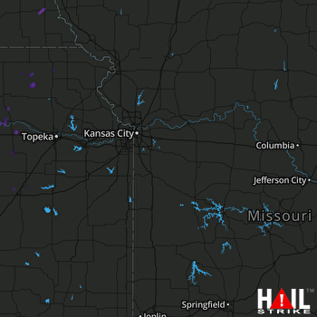 KANSAS CITY (KEAX) RADAR

