This weather event on August 17, 2025 includes:
3 states
28 counties,
15 cities,
and 65 zip codes.
There were total properties that were impacted and have possible damage.
States Impacted By Hail On August 17, 2025
Arkansas
·
Missouri
·
Oklahoma
Counties Impacted By Hail On August 17, 2025
Baxter, AR
·
Cleburne, AR
·
Conway, AR
·
Dallas, AR
·
Faulkner, AR
·
Fulton, AR
·
Garland, AR
·
Grant, AR
·
Hot Spring, AR
·
Howard, AR
·
Independence, AR
·
Izard, AR
·
Lonoke, AR
·
Montgomery, AR
·
Ouachita, AR
·
Perry, AR
·
Polk, AR
·
Pulaski, AR
·
Scott, AR
·
Searcy, AR
·
Stone, AR
·
Van Buren, AR
·
White, AR
·
Lawrence, MO
·
Stone, MO
·
Lincoln, OK
·
Pottawatomie, OK
·
Seminole, OK
Cities Impacted By Hail On August 17, 2025
Aurora, MO
·
Austin, AR
·
Cabot, AR
·
Clinton, AR
·
Conway, AR
·
Dennard, AR
·
Maumelle, AR
·
Mayflower, AR
·
North Little Rock, AR
·
Prague, OK
·
Prattsville, AR
·
Searcy, AR
·
Seminole, OK
·
Sheridan, AR
·
Stroud, OK
Zip Codes Impacted By Hail On August 17, 2025
65747
·
65769
·
71602
·
71720
·
71725
·
71742
·
71763
·
71953
·
71961
·
71972
·
71973
·
72007
·
72013
·
72023
·
72027
·
72030
·
72031
·
72032
·
72034
·
72047
·
72057
·
72058
·
72067
·
72080
·
72102
·
72106
·
72113
·
72114
·
72116
·
72118
·
72120
·
72121
·
72126
·
72128
·
72129
·
72131
·
72137
·
72141
·
72143
·
72150
·
72173
·
72501
·
72517
·
72528
·
72531
·
72543
·
72555
·
72556
·
72560
·
72566
·
72585
·
72629
·
72645
·
72650
·
72857
·
72926
·
74079
·
74840
·
74852
·
74864
·
74868
·
74873
·
65605
·
71913
·
72519
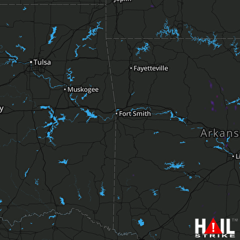 FORT SMITH (KSRX) RADAR

