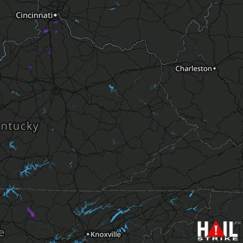
This weather event on August 15, 2025 includes:
5 states
29 counties,
25 cities,
and 59 zip codes.
There were total properties that were impacted and have possible damage.
States Impacted By Hail On August 15, 2025
Indiana
·
Kentucky
·
North Carolina
·
Tennessee
·
Virginia
Counties Impacted By Hail On August 15, 2025
Switzerland, IN
·
Anderson, KY
·
Boone, KY
·
Campbell, KY
·
Franklin, KY
·
Gallatin, KY
·
Grant, KY
·
Henry, KY
·
Jessamine, KY
·
Kenton, KY
·
Madison, KY
·
Marion, KY
·
Mercer, KY
·
Nelson, KY
·
Owen, KY
·
Pendleton, KY
·
Scott, KY
·
Shelby, KY
·
Washington, KY
·
Woodford, KY
·
Haywood, NC
·
Swain, NC
·
Blount, TN
·
Cumberland, TN
·
Fentress, TN
·
Hancock, TN
·
Overton, TN
·
Putnam, TN
·
Lee, VA
Cities Impacted By Hail On August 15, 2025
Clarkrange, TN
·
Cold Spring, KY
·
Corinth, KY
·
Covington, KY
·
Crestview Hills, KY
·
Crittenden, KY
·
Edgewood, KY
·
Florence, KY
·
Fort Mitchell, KY
·
Fort Thomas, KY
·
Fort Wright, KY
·
Frankfort, KY
·
Glencoe, KY
·
Grimsley, TN
·
Highland Heights, KY
·
Independence, KY
·
Lakeside Park, KY
·
Lawrenceburg, KY
·
Maggie Valley, NC
·
Richmond, KY
·
Southgate, KY
·
Taylor Mill, KY
·
Union, KY
·
Wilder, KY
·
Williamstown, KY
Zip Codes Impacted By Hail On August 15, 2025
24221
·
28721
·
28785
·
37726
·
37731
·
37765
·
37878
·
37882
·
38553
·
38556
·
38565
·
38571
·
38574
·
38589
·
40004
·
40007
·
40013
·
40033
·
40036
·
40046
·
40057
·
40065
·
40076
·
40324
·
40328
·
40330
·
40339
·
40342
·
40347
·
40356
·
40359
·
40372
·
40383
·
40475
·
40601
·
40604
·
41010
·
41011
·
41015
·
41017
·
41030
·
41033
·
41035
·
41042
·
41046
·
41051
·
41052
·
41063
·
41071
·
41075
·
41076
·
41086
·
41091
·
41094
·
41095
·
41097
·
41098
·
41099
·
47038
 JACKSON (KJKL) RADAR

