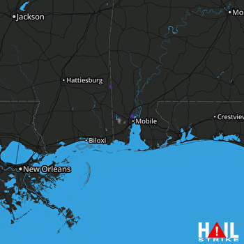
This weather event on August 14, 2025 includes:
4 states
16 counties,
19 cities,
and 61 zip codes.
There were 21310 total properties that were impacted and have possible damage.
States Impacted By Hail On August 14, 2025
Alabama
·
Florida
·
Louisiana
·
Mississippi
Counties Impacted By Hail On August 14, 2025
Baldwin, AL
·
Mobile, AL
·
Washington, AL
·
Escambia, FL
·
Tangipahoa, LA
·
Covington, MS
·
Forrest, MS
·
George, MS
·
Greene, MS
·
Jackson, MS
·
Jasper, MS
·
Jones, MS
·
Lawrence, MS
·
Perry, MS
·
Smith, MS
·
Wayne, MS
Cities Impacted By Hail On August 14, 2025
Axis, AL
·
Bay Minette, AL
·
Chickasaw, AL
·
Citronelle, AL
·
Creola, AL
·
Fairford, AL
·
Glendale, MS
·
Gulfcrest, AL
·
Hattiesburg, MS
·
Kentwood, LA
·
Mobile, AL
·
Mount Vernon, AL
·
Prichard, AL
·
Saraland, AL
·
Satsuma, AL
·
Semmes, AL
·
Tangipahoa, LA
·
Tillmans Corner, AL
·
Waynesboro, MS
Zip Codes Impacted By Hail On August 14, 2025
32577
·
36505
·
36507
·
36513
·
36518
·
36521
·
36522
·
36525
·
36529
·
36541
·
36553
·
36558
·
36560
·
36567
·
36569
·
36571
·
36572
·
36575
·
36582
·
36583
·
36584
·
36585
·
36587
·
36603
·
36605
·
36606
·
36607
·
36608
·
36609
·
36610
·
36611
·
36612
·
36613
·
36615
·
36616
·
36617
·
36618
·
36619
·
36688
·
36693
·
36695
·
39074
·
39168
·
39191
·
39322
·
39362
·
39367
·
39401
·
39422
·
39451
·
39452
·
39476
·
39562
·
39654
·
39665
·
70444
·
70465
·
39479
·
39338
·
36539
·
32533
 MOBILE (KMOB) RADAR

