This weather event on August 13, 2025 includes:
1 states
25 counties,
12 cities,
and 68 zip codes.
There were 307 total properties that were impacted and have possible damage.
States Impacted By Hail On August 13, 2025
Nebraska
Counties Impacted By Hail On August 13, 2025
Antelope, NE
·
Blaine, NE
·
Boone, NE
·
Colfax, NE
·
Custer, NE
·
Gage, NE
·
Garfield, NE
·
Greeley, NE
·
Hamilton, NE
·
Holt, NE
·
Howard, NE
·
Lancaster, NE
·
Loup, NE
·
Madison, NE
·
Merrick, NE
·
Nance, NE
·
Pierce, NE
·
Polk, NE
·
Rock, NE
·
Seward, NE
·
Sherman, NE
·
Stanton, NE
·
Valley, NE
·
Wheeler, NE
·
York, NE
Cities Impacted By Hail On August 13, 2025
Bartlett, NE
·
Benedict, NE
·
Chambers, NE
·
Clarks, NE
·
Clarkson, NE
·
Clearwater, NE
·
Cordova, NE
·
Ericson, NE
·
Loup City, NE
·
Polk, NE
·
Scotia, NE
·
York, NE
Zip Codes Impacted By Hail On August 13, 2025
68313
·
68316
·
68319
·
68331
·
68333
·
68339
·
68351
·
68359
·
68368
·
68401
·
68404
·
68405
·
68423
·
68460
·
68467
·
68620
·
68622
·
68623
·
68627
·
68628
·
68629
·
68636
·
68637
·
68638
·
68640
·
68642
·
68644
·
68651
·
68652
·
68654
·
68655
·
68660
·
68663
·
68665
·
68666
·
68701
·
68711
·
68713
·
68714
·
68725
·
68726
·
68735
·
68748
·
68758
·
68763
·
68767
·
68813
·
68814
·
68815
·
68821
·
68822
·
68823
·
68825
·
68826
·
68828
·
68833
·
68835
·
68837
·
68842
·
68843
·
68853
·
68855
·
68859
·
68862
·
68874
·
68875
·
68879
·
68882
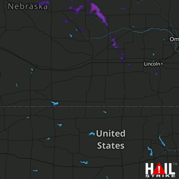 HASTINGS (KUEX) RADAR

