This weather event on August 11, 2025 includes:
1 states
22 counties,
13 cities,
and 85 zip codes.
There were 1554 total properties that were impacted and have possible damage.
States Impacted By Hail On August 11, 2025
North Dakota
Counties Impacted By Hail On August 11, 2025
Benson, ND
·
Burleigh, ND
·
Dunn, ND
·
Eddy, ND
·
Emmons, ND
·
Foster, ND
·
Kidder, ND
·
LaMoure, ND
·
Logan, ND
·
McHenry, ND
·
McLean, ND
·
Mercer, ND
·
Mountrail, ND
·
Nelson, ND
·
Oliver, ND
·
Pierce, ND
·
Ransom, ND
·
Sargent, ND
·
Sheridan, ND
·
Stutsman, ND
·
Ward, ND
·
Wells, ND
Cities Impacted By Hail On August 11, 2025
Coleharbor, ND
·
Drake, ND
·
Hamberg, ND
·
Hurdsfield, ND
·
Jamestown, ND
·
Minot, ND
·
Palermo, ND
·
Regan, ND
·
Stanley, ND
·
Tappen, ND
·
Tolna, ND
·
Underwood, ND
·
York, ND
Zip Codes Impacted By Hail On August 11, 2025
58017
·
58040
·
58054
·
58069
·
58254
·
58332
·
58341
·
58344
·
58346
·
58348
·
58356
·
58361
·
58368
·
58374
·
58380
·
58386
·
58401
·
58405
·
58418
·
58420
·
58421
·
58422
·
58423
·
58424
·
58428
·
58438
·
58442
·
58443
·
58444
·
58445
·
58451
·
58454
·
58467
·
58474
·
58475
·
58476
·
58477
·
58478
·
58482
·
58483
·
58486
·
58487
·
58488
·
58494
·
58496
·
58503
·
58504
·
58521
·
58530
·
58531
·
58532
·
58540
·
58544
·
58545
·
58558
·
58559
·
58561
·
58575
·
58576
·
58577
·
58579
·
58636
·
58640
·
58642
·
58701
·
58710
·
58712
·
58718
·
58736
·
58741
·
58744
·
58756
·
58768
·
58769
·
58770
·
58771
·
58775
·
58781
·
58784
·
58788
·
58790
·
58430
·
58463
·
58723
·
58779
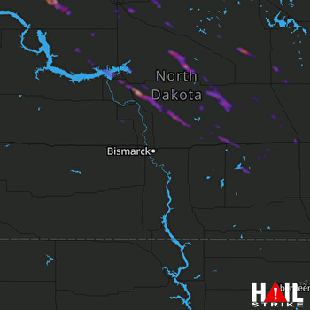 BISMARCK (KBIS) RADAR

