This weather event on August 4, 2025 includes:
3 states
21 counties,
18 cities,
and 69 zip codes.
There were 7298 total properties that were impacted and have possible damage.
States Impacted By Hail On August 4, 2025
Illinois
·
Kentucky
·
Missouri
Counties Impacted By Hail On August 4, 2025
Alexander, IL
·
Hardin, IL
·
Johnson, IL
·
Massac, IL
·
Pope, IL
·
Pulaski, IL
·
Union, IL
·
Williamson, IL
·
Ballard, KY
·
Carlisle, KY
·
Crittenden, KY
·
Graves, KY
·
Livingston, KY
·
Marshall, KY
·
McCracken, KY
·
Bollinger, MO
·
Cape Girardeau, MO
·
New Madrid, MO
·
Scott, MO
·
Stoddard, MO
·
Wayne, MO
Cities Impacted By Hail On August 4, 2025
Allenville, MO
·
Bell City, MO
·
Brookport, IL
·
Creal Springs, IL
·
Delta, MO
·
Farley, KY
·
Goreville, IL
·
Hendron, KY
·
Ledbetter, KY
·
Lowes, KY
·
Marion, IL
·
Massac, KY
·
Metropolis, IL
·
Paducah, KY
·
Reidland, KY
·
Tolu, KY
·
Vienna, IL
·
Whitewater, MO
Zip Codes Impacted By Hail On August 4, 2025
42001
·
42003
·
42024
·
42025
·
42027
·
42028
·
42029
·
42035
·
42039
·
42051
·
42053
·
42056
·
42058
·
42061
·
42064
·
42066
·
42069
·
42078
·
42081
·
42082
·
42084
·
42086
·
62902
·
62906
·
62910
·
62912
·
62920
·
62923
·
62926
·
62931
·
62938
·
62939
·
62941
·
62943
·
62952
·
62957
·
62958
·
62959
·
62960
·
62963
·
62970
·
62972
·
62992
·
62995
·
62996
·
63701
·
63730
·
63735
·
63740
·
63744
·
63745
·
63751
·
63764
·
63771
·
63774
·
63785
·
63825
·
63833
·
63841
·
63845
·
63862
·
63867
·
63869
·
63936
·
63960
·
63966
·
62922
·
62956
·
62985
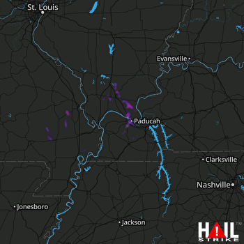 PADUCAH (KPAH) RADAR

