This weather event on August 2, 2025 includes:
1 states
30 counties,
8 cities,
and 76 zip codes.
There were 371 total properties that were impacted and have possible damage.
States Impacted By Hail On August 2, 2025
Texas
Counties Impacted By Hail On August 2, 2025
Bandera, TX
·
Blanco, TX
·
Brown, TX
·
Coke, TX
·
Coleman, TX
·
Concho, TX
·
Crockett, TX
·
Edwards, TX
·
Gillespie, TX
·
Irion, TX
·
Kendall, TX
·
Kerr, TX
·
Kimble, TX
·
Kinney, TX
·
Lampasas, TX
·
Llano, TX
·
Mason, TX
·
McCulloch, TX
·
Medina, TX
·
Menard, TX
·
Pecos, TX
·
Real, TX
·
Runnels, TX
·
San Saba, TX
·
Schleicher, TX
·
Sutton, TX
·
Terrell, TX
·
Tom Green, TX
·
Uvalde, TX
·
Val Verde, TX
Cities Impacted By Hail On August 2, 2025
Grape Creek, TX
·
Harper, TX
·
Horseshoe Bay, TX
·
Kerrville, TX
·
Lometa, TX
·
Round Mountain, TX
·
San Angelo, TX
·
San Saba, TX
Zip Codes Impacted By Hail On August 2, 2025
76550
·
76801
·
76825
·
76834
·
76836
·
76837
·
76845
·
76849
·
76852
·
76853
·
76854
·
76856
·
76858
·
76859
·
76861
·
76862
·
76866
·
76869
·
76872
·
76873
·
76874
·
76877
·
76885
·
76887
·
76888
·
76901
·
76903
·
76904
·
76905
·
76933
·
76936
·
76937
·
76940
·
76941
·
76943
·
76950
·
76953
·
76955
·
76957
·
78003
·
78006
·
78010
·
78013
·
78024
·
78025
·
78028
·
78055
·
78058
·
78618
·
78624
·
78631
·
78635
·
78636
·
78643
·
78663
·
78675
·
78801
·
78828
·
78832
·
78833
·
78838
·
78870
·
78873
·
78879
·
78880
·
78881
·
78883
·
78884
·
78885
·
79735
·
79744
·
79781
·
79848
·
78861
·
78657
·
76871
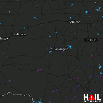 SAN ANGELO (KSJT) RADAR

