This weather event on July 31, 2025 includes:
3 states
25 counties,
11 cities,
and 54 zip codes.
There were total properties that were impacted and have possible damage.
States Impacted By Hail On July 31, 2025
Kentucky
·
Ohio
·
West Virginia
Counties Impacted By Hail On July 31, 2025
Breathitt, KY
·
Estill, KY
·
Fayette, KY
·
Floyd, KY
·
Garrard, KY
·
Greenup, KY
·
Jessamine, KY
·
Johnson, KY
·
Lawrence, KY
·
Lee, KY
·
Madison, KY
·
Magoffin, KY
·
Martin, KY
·
Mercer, KY
·
Morgan, KY
·
Oldham, KY
·
Owsley, KY
·
Perry, KY
·
Shelby, KY
·
Meigs, OH
·
Jackson, WV
·
Lincoln, WV
·
Logan, WV
·
Wayne, WV
·
Wood, WV
Cities Impacted By Hail On July 31, 2025
Auxier, KY
·
Beattyville, KY
·
High Bridge, KY
·
Inez, KY
·
Irvine, KY
·
Jackson, KY
·
Lexington-Fayette, KY
·
Louisa, KY
·
Martin, KY
·
Prestonsburg, KY
·
Ravenna, KY
Zip Codes Impacted By Hail On July 31, 2025
25508
·
25511
·
25514
·
25517
·
25524
·
25570
·
26133
·
26164
·
40014
·
40065
·
40068
·
40330
·
40336
·
40356
·
40385
·
40390
·
40444
·
40447
·
40472
·
40502
·
40503
·
40515
·
40517
·
41121
·
41143
·
41144
·
41214
·
41216
·
41222
·
41224
·
41230
·
41262
·
41265
·
41301
·
41311
·
41314
·
41339
·
41348
·
41366
·
41390
·
41465
·
41472
·
41602
·
41645
·
41649
·
41653
·
41721
·
41745
·
45743
·
45771
·
45772
·
40509
·
41601
·
45770
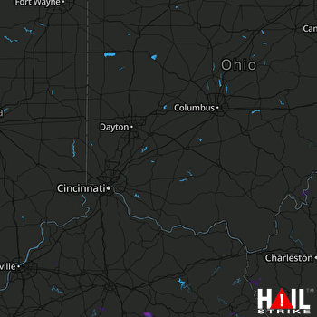 CINCINNATI (KILN) RADAR

