This weather event on July 22, 2025 includes:
4 states
30 counties,
16 cities,
and 89 zip codes.
There were 2520 total properties that were impacted and have possible damage.
States Impacted By Hail On July 22, 2025
Montana
·
Nebraska
·
South Dakota
·
Wyoming
Counties Impacted By Hail On July 22, 2025
Carter, MT
·
Box Butte, NE
·
Cherry, NE
·
Dawes, NE
·
Sheridan, NE
·
Bennett, SD
·
Corson, SD
·
Custer, SD
·
Dewey, SD
·
Fall River, SD
·
Haakon, SD
·
Hughes, SD
·
Jackson, SD
·
Jones, SD
·
Lawrence, SD
·
Lyman, SD
·
Meade, SD
·
Mellette, SD
·
Oglala Lakota, SD
·
Pennington, SD
·
Perkins, SD
·
Potter, SD
·
Stanley, SD
·
Sully, SD
·
Todd, SD
·
Tripp, SD
·
Ziebach, SD
·
Converse, WY
·
Niobrara, WY
·
Weston, WY
Cities Impacted By Hail On July 22, 2025
Antelope, SD
·
Ashland Heights, SD
·
Box Elder, SD
·
Crookston, NE
·
Draper, SD
·
Eagle Butte, SD
·
Gordon, NE
·
La Plant, SD
·
Mission, SD
·
North Eagle Butte, SD
·
Piedmont, SD
·
Presho, SD
·
Rapid City, SD
·
Valentine, NE
·
White Horse, SD
·
Wood, SD
Zip Codes Impacted By Hail On July 22, 2025
57442
·
57501
·
57520
·
57521
·
57531
·
57532
·
57537
·
57541
·
57544
·
57551
·
57552
·
57553
·
57555
·
57559
·
57560
·
57564
·
57567
·
57568
·
57570
·
57572
·
57576
·
57579
·
57580
·
57584
·
57585
·
57601
·
57620
·
57622
·
57623
·
57625
·
57626
·
57630
·
57633
·
57636
·
57644
·
57652
·
57656
·
57657
·
57701
·
57702
·
57703
·
57706
·
57714
·
57716
·
57718
·
57719
·
57724
·
57735
·
57744
·
57745
·
57748
·
57751
·
57752
·
57754
·
57761
·
57763
·
57767
·
57769
·
57770
·
57772
·
57785
·
57787
·
57790
·
57791
·
57792
·
57794
·
59311
·
69211
·
69212
·
69216
·
69218
·
69219
·
69301
·
69337
·
69343
·
69351
·
69360
·
82222
·
82224
·
82229
·
82633
·
82701
·
82723
·
82730
·
57543
·
57562
·
57750
·
57783
·
69201
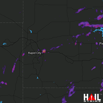 RAPID CITY (KUDX) RADAR

