This weather event on July 19, 2025 includes:
2 states
16 counties,
24 cities,
and 53 zip codes.
There were 146 total properties that were impacted and have possible damage.
States Impacted By Hail On July 19, 2025
Florida
·
Georgia
Counties Impacted By Hail On July 19, 2025
Citrus, FL
·
Clay, FL
·
Duval, FL
·
Flagler, FL
·
Hernando, FL
·
Jefferson, FL
·
Lake, FL
·
Leon, FL
·
Levy, FL
·
Marion, FL
·
Pasco, FL
·
Putnam, FL
·
St. Johns, FL
·
Sumter, FL
·
Volusia, FL
·
Brooks, GA
Cities Impacted By Hail On July 19, 2025
Bunnell, FL
·
Bushnell, FL
·
Coleman, FL
·
DeLand, FL
·
DeLand Southwest, FL
·
Dunnellon, FL
·
Floral City, FL
·
Fruit Cove, FL
·
Hill 'n Dale, FL
·
Istachatta, FL
·
Jacksonville, FL
·
Lake Helen, FL
·
Lake Kathryn, FL
·
Lake Panasoffkee, FL
·
Leesburg, FL
·
Monticello, FL
·
Nobleton, FL
·
North DeLand, FL
·
Ocala, FL
·
Paisley, FL
·
Silver Springs Shores, FL
·
Spring Lake, FL
·
The Villages, FL
·
Wildwood, FL
Zip Codes Impacted By Hail On July 19, 2025
31643
·
32033
·
32043
·
32092
·
32110
·
32112
·
32130
·
32159
·
32162
·
32177
·
32180
·
32181
·
32187
·
32189
·
32190
·
32259
·
32309
·
32311
·
32312
·
32317
·
32344
·
32668
·
32702
·
32720
·
32724
·
32736
·
32744
·
32767
·
32776
·
33513
·
33514
·
33521
·
33523
·
33538
·
33585
·
33597
·
34431
·
34432
·
34436
·
34472
·
34473
·
34474
·
34476
·
34480
·
34482
·
34484
·
34601
·
34602
·
34661
·
34714
·
34736
·
34785
·
32258
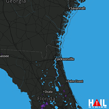 JACKSONVILLE (KJAX) RADAR

