This weather event on July 12, 2025 includes:
3 states
19 counties,
17 cities,
and 58 zip codes.
There were total properties that were impacted and have possible damage.
States Impacted By Hail On July 12, 2025
Illinois
·
Kentucky
·
Missouri
Counties Impacted By Hail On July 12, 2025
Alexander, IL
·
Pulaski, IL
·
Ballard, KY
·
Butler, MO
·
Carter, MO
·
Dallas, MO
·
Howell, MO
·
Iron, MO
·
Laclede, MO
·
Mississippi, MO
·
New Madrid, MO
·
Reynolds, MO
·
Scott, MO
·
Shannon, MO
·
Stoddard, MO
·
Texas, MO
·
Wayne, MO
·
Webster, MO
·
Wright, MO
Cities Impacted By Hail On July 12, 2025
Baker, MO
·
Barlow, KY
·
Birch Tree, MO
·
Cairo, IL
·
Charleston, MO
·
Conway, MO
·
Hartville, MO
·
Houston, MO
·
Miner, MO
·
Montier, MO
·
Morehouse, MO
·
Morley, MO
·
Mound City, IL
·
Mountain Grove, MO
·
Puxico, MO
·
Sikeston, MO
·
Vanduser, MO
Zip Codes Impacted By Hail On July 12, 2025
42024
·
42053
·
42056
·
42087
·
62914
·
62962
·
62963
·
62964
·
63665
·
63675
·
63730
·
63735
·
63736
·
63767
·
63771
·
63784
·
63801
·
63823
·
63825
·
63834
·
63845
·
63846
·
63867
·
63868
·
63941
·
63944
·
63957
·
63960
·
63966
·
63967
·
65438
·
65444
·
65464
·
65466
·
65470
·
65483
·
65484
·
65536
·
65548
·
65552
·
65564
·
65571
·
65588
·
65632
·
65660
·
65667
·
65689
·
65704
·
65711
·
65713
·
65717
·
65722
·
65793
·
63620
·
63636
·
63654
·
65543
·
65662
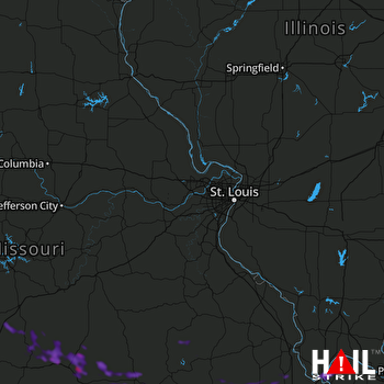 ST LOUIS (KLSX) RADAR

