This weather event on July 12, 2025 includes:
2 states
28 counties,
15 cities,
and 76 zip codes.
There were 712 total properties that were impacted and have possible damage.
States Impacted By Hail On July 12, 2025
Louisiana
·
Texas
Counties Impacted By Hail On July 12, 2025
Allen, LA
·
Calcasieu, LA
·
Cameron, LA
·
Jefferson Davis, LA
·
Angelina, TX
·
Austin, TX
·
Bastrop, TX
·
Brazos, TX
·
Caldwell, TX
·
Colorado, TX
·
Gonzales, TX
·
Grimes, TX
·
Hardin, TX
·
Harris, TX
·
Houston, TX
·
Lee, TX
·
Leon, TX
·
Madison, TX
·
Montgomery, TX
·
Nacogdoches, TX
·
Polk, TX
·
Robertson, TX
·
San Augustine, TX
·
San Jacinto, TX
·
Trinity, TX
·
Tyler, TX
·
Walker, TX
·
Williamson, TX
Cities Impacted By Hail On July 12, 2025
Bastrop, TX
·
Camp Swift, TX
·
Circle D-KC Estates, TX
·
Conroe, TX
·
Cut and Shoot, TX
·
Diboll, TX
·
Groveton, TX
·
Hudson, TX
·
Huntsville, TX
·
Lufkin, TX
·
The Woodlands, TX
·
Trinity, TX
·
West Livingston, TX
·
Westwood Shores, TX
·
Wildwood, TX
Zip Codes Impacted By Hail On July 12, 2025
70633
·
70643
·
70648
·
70658
·
70663
·
70668
·
75835
·
75845
·
75847
·
75851
·
75852
·
75856
·
75862
·
75901
·
75904
·
75926
·
75929
·
75937
·
75939
·
75941
·
75944
·
75961
·
75964
·
75969
·
76578
·
77301
·
77302
·
77303
·
77304
·
77306
·
77320
·
77334
·
77336
·
77340
·
77351
·
77358
·
77359
·
77363
·
77376
·
77378
·
77379
·
77384
·
77385
·
77474
·
77532
·
77616
·
77625
·
77656
·
77660
·
77663
·
77664
·
77830
·
77831
·
77856
·
77859
·
77861
·
77864
·
77868
·
77871
·
77872
·
77873
·
77876
·
78602
·
78612
·
78621
·
78632
·
78650
·
78659
·
78662
·
78933
·
78947
·
78948
·
78953
·
78959
·
77331
·
75972
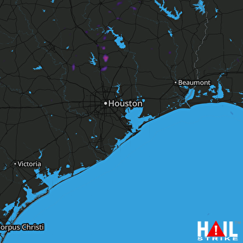 HOUSTON (KHGX) RADAR

