This weather event on July 11, 2025 includes:
1 states
15 counties,
21 cities,
and 52 zip codes.
There were 109 total properties that were impacted and have possible damage.
States Impacted By Hail On July 11, 2025
Iowa
Counties Impacted By Hail On July 11, 2025
Benton, IA
·
Black Hawk, IA
·
Bremer, IA
·
Buchanan, IA
·
Butler, IA
·
Chickasaw, IA
·
Delaware, IA
·
Fayette, IA
·
Floyd, IA
·
Franklin, IA
·
Grundy, IA
·
Linn, IA
·
Tama, IA
·
Winneshiek, IA
·
Wright, IA
Cities Impacted By Hail On July 11, 2025
Aredale, IA
·
Coulter, IA
·
Fredericksburg, IA
·
Greene, IA
·
Grundy Center, IA
·
Hampton, IA
·
Hansell, IA
·
Independence, IA
·
Jackson Junction, IA
·
Latimer, IA
·
Lawler, IA
·
Lincoln, IA
·
Manchester, IA
·
Morrison, IA
·
Nashua, IA
·
New Hampton, IA
·
Quasqueton, IA
·
Reinbeck, IA
·
Rowley, IA
·
Walker, IA
·
Washburn, IA
Zip Codes Impacted By Hail On July 11, 2025
50071
·
50433
·
50452
·
50475
·
50602
·
50605
·
50609
·
50611
·
50616
·
50619
·
50621
·
50625
·
50627
·
50630
·
50633
·
50635
·
50636
·
50638
·
50642
·
50643
·
50644
·
50645
·
50648
·
50650
·
50651
·
50652
·
50654
·
50658
·
50659
·
50662
·
50666
·
50667
·
50669
·
50671
·
50682
·
50701
·
50702
·
50703
·
52057
·
52144
·
52154
·
52171
·
52210
·
52213
·
52218
·
52313
·
52326
·
52329
·
52330
·
52349
·
52352
·
50441
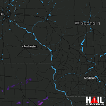 LA CROSSE (KARX) RADAR

