This weather event on July 1, 2025 includes:
1 states
19 counties,
29 cities,
and 65 zip codes.
There were 221 total properties that were impacted and have possible damage.
States Impacted By Hail On July 1, 2025
Nebraska
Counties Impacted By Hail On July 1, 2025
Adams, NE
·
Boone, NE
·
Buffalo, NE
·
Clay, NE
·
Fillmore, NE
·
Garfield, NE
·
Greeley, NE
·
Hall, NE
·
Hamilton, NE
·
Howard, NE
·
Merrick, NE
·
Nance, NE
·
Polk, NE
·
Seward, NE
·
Sherman, NE
·
Valley, NE
·
Wayne, NE
·
Wheeler, NE
·
York, NE
Cities Impacted By Hail On July 1, 2025
Alda, NE
·
Archer, NE
·
Aurora, NE
·
Bradshaw, NE
·
Central City, NE
·
Chapman, NE
·
Cotesfield, NE
·
Cushing, NE
·
Giltner, NE
·
Grand Island, NE
·
Greeley Center, NE
·
Hampton, NE
·
Henderson, NE
·
Hordville, NE
·
Howard City, NE
·
McCool Junction, NE
·
Ord, NE
·
Overland, NE
·
Palmer, NE
·
Phillips, NE
·
Seward, NE
·
St. Libory, NE
·
St. Paul, NE
·
Tamora, NE
·
Thayer, NE
·
Trumbull, NE
·
Utica, NE
·
Wolbach, NE
·
Wood River, NE
Zip Codes Impacted By Hail On July 1, 2025
68313
·
68314
·
68316
·
68319
·
68351
·
68354
·
68371
·
68401
·
68434
·
68456
·
68460
·
68467
·
68622
·
68623
·
68627
·
68637
·
68638
·
68651
·
68654
·
68665
·
68666
·
68723
·
68740
·
68771
·
68790
·
68801
·
68803
·
68810
·
68815
·
68816
·
68817
·
68818
·
68820
·
68823
·
68824
·
68826
·
68827
·
68831
·
68832
·
68835
·
68837
·
68838
·
68841
·
68842
·
68843
·
68846
·
68847
·
68852
·
68853
·
68854
·
68859
·
68864
·
68865
·
68869
·
68871
·
68872
·
68873
·
68875
·
68883
·
68901
·
68944
·
68980
·
68882
·
68862
·
68628
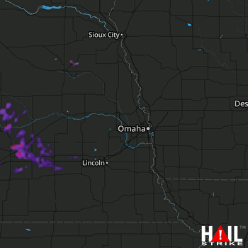 OMAHA (KOAX) RADAR

