This weather event on June 27, 2025 includes:
4 states
30 counties,
13 cities,
and 69 zip codes.
There were 6040 total properties that were impacted and have possible damage.
States Impacted By Hail On June 27, 2025
Alabama
·
Florida
·
Louisiana
·
Mississippi
Counties Impacted By Hail On June 27, 2025
Baldwin, AL
·
Butler, AL
·
Choctaw, AL
·
Clarke, AL
·
Crenshaw, AL
·
Escambia, AL
·
Greene, AL
·
Hale, AL
·
Marengo, AL
·
Mobile, AL
·
Monroe, AL
·
Perry, AL
·
Sumter, AL
·
Washington, AL
·
Escambia, FL
·
Santa Rosa, FL
·
Washington, LA
·
Clarke, MS
·
Forrest, MS
·
George, MS
·
Greene, MS
·
Jackson, MS
·
Lamar, MS
·
Lauderdale, MS
·
Marion, MS
·
Pearl River, MS
·
Perry, MS
·
Rankin, MS
·
Walthall, MS
·
Wayne, MS
Cities Impacted By Hail On June 27, 2025
Carlton, AL
·
Foxworth, MS
·
Hurley, MS
·
Jay, FL
·
Meridian, MS
·
Mobile, AL
·
Pine Level, FL
·
Poplarville, MS
·
Prichard, AL
·
Rawls Springs, MS
·
Saraland, AL
·
Semmes, AL
·
Spanish Fort, AL
Zip Codes Impacted By Hail On June 27, 2025
32535
·
32565
·
32568
·
36049
·
36071
·
36426
·
36444
·
36456
·
36480
·
36502
·
36507
·
36521
·
36522
·
36524
·
36527
·
36545
·
36550
·
36553
·
36558
·
36571
·
36575
·
36581
·
36587
·
36606
·
36608
·
36609
·
36610
·
36612
·
36613
·
36618
·
36693
·
36695
·
36727
·
36732
·
36740
·
36744
·
36765
·
36776
·
36782
·
36786
·
36921
·
36922
·
36925
·
39044
·
39307
·
39322
·
39355
·
39360
·
39367
·
39402
·
39426
·
39429
·
39452
·
39464
·
39465
·
39466
·
39470
·
39476
·
39478
·
39482
·
39483
·
39562
·
70426
·
70427
·
70438
·
70450
·
39451
·
39042
·
36748
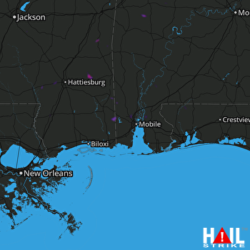 MOBILE (KMOB) RADAR

