This weather event on June 24, 2025 includes:
4 states
34 counties,
16 cities,
and 83 zip codes.
There were 59 total properties that were impacted and have possible damage.
States Impacted By Hail On June 24, 2025
Colorado
·
Kansas
·
Nebraska
·
South Dakota
Counties Impacted By Hail On June 24, 2025
Logan, CO
·
Phillips, CO
·
Sedgwick, CO
·
Yuma, CO
·
Decatur, KS
·
Norton, KS
·
Arthur, NE
·
Brown, NE
·
Buffalo, NE
·
Chase, NE
·
Cherry, NE
·
Dawson, NE
·
Deuel, NE
·
Dundy, NE
·
Frontier, NE
·
Furnas, NE
·
Garden, NE
·
Gosper, NE
·
Hayes, NE
·
Hitchcock, NE
·
Kearney, NE
·
Keith, NE
·
Keya Paha, NE
·
Lincoln, NE
·
Logan, NE
·
Perkins, NE
·
Phelps, NE
·
Red Willow, NE
·
Sheridan, NE
·
Sherman, NE
·
Bennett, SD
·
Mellette, SD
·
Todd, SD
·
Tripp, SD
Cities Impacted By Hail On June 24, 2025
Belmar, NE
·
Big Springs, NE
·
Culbertson, NE
·
Enders, NE
·
Hamlet, NE
·
Haxtun, CO
·
Indianola, NE
·
Lebanon, NE
·
Loomis, NE
·
Max, NE
·
Nenzel, NE
·
Overton, NE
·
Ovid, CO
·
Paoli, CO
·
Stratton, NE
·
Wauneta, NE
Zip Codes Impacted By Hail On June 24, 2025
57551
·
57566
·
57574
·
57580
·
67653
·
67749
·
68836
·
68852
·
68853
·
68863
·
68869
·
68924
·
68927
·
68937
·
68940
·
68948
·
68958
·
69001
·
69020
·
69021
·
69023
·
69024
·
69025
·
69026
·
69027
·
69028
·
69029
·
69030
·
69032
·
69033
·
69034
·
69036
·
69037
·
69038
·
69039
·
69040
·
69041
·
69043
·
69044
·
69045
·
69046
·
69101
·
69121
·
69122
·
69123
·
69127
·
69129
·
69132
·
69134
·
69138
·
69140
·
69146
·
69147
·
69148
·
69150
·
69151
·
69153
·
69154
·
69163
·
69168
·
69169
·
69170
·
69201
·
69212
·
69214
·
69216
·
69218
·
69219
·
69220
·
69221
·
69343
·
80728
·
80731
·
80734
·
80737
·
80744
·
80746
·
80758
·
80721
·
69211
·
69152
·
69022
·
57560
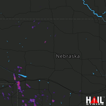 NORTH PLATTE (KLNX) RADAR

