This weather event on June 23, 2025 includes:
4 states
32 counties,
17 cities,
and 72 zip codes.
There were 96 total properties that were impacted and have possible damage.
States Impacted By Hail On June 23, 2025
Illinois
·
Kentucky
·
Missouri
·
Tennessee
Counties Impacted By Hail On June 23, 2025
Alexander, IL
·
Johnson, IL
·
Massac, IL
·
Pope, IL
·
Anderson, KY
·
Bullitt, KY
·
Caldwell, KY
·
Calloway, KY
·
Christian, KY
·
Crittenden, KY
·
Fulton, KY
·
Graves, KY
·
Hardin, KY
·
Hickman, KY
·
Hopkins, KY
·
Livingston, KY
·
Lyon, KY
·
McCracken, KY
·
McLean, KY
·
Muhlenberg, KY
·
Nelson, KY
·
Shelby, KY
·
Spencer, KY
·
Trigg, KY
·
Washington, KY
·
Mississippi, MO
·
Scott, MO
·
Henry, TN
·
Houston, TN
·
Obion, TN
·
Stewart, TN
·
Weakley, TN
Cities Impacted By Hail On June 23, 2025
Bardstown, KY
·
Brookport, IL
·
Clinton, KY
·
Cottage Grove, TN
·
Elizabethtown, KY
·
Fort Campbell North, KY
·
Madisonville, KY
·
Metropolis, IL
·
Mount Washington, KY
·
Oak Grove, KY
·
Olive Branch, IL
·
Paris, TN
·
Princeton, KY
·
Puryear, TN
·
Radcliff, KY
·
Union City, TN
·
Wingo, KY
Zip Codes Impacted By Hail On June 23, 2025
37028
·
37058
·
37175
·
38201
·
38224
·
38229
·
38241
·
38242
·
38251
·
38256
·
38261
·
40003
·
40004
·
40008
·
40012
·
40013
·
40065
·
40069
·
40071
·
40076
·
40078
·
40162
·
40342
·
42001
·
42003
·
42027
·
42031
·
42038
·
42039
·
42041
·
42049
·
42051
·
42064
·
42066
·
42071
·
42079
·
42081
·
42085
·
42088
·
42211
·
42217
·
42223
·
42232
·
42236
·
42262
·
42345
·
42371
·
42411
·
42431
·
42445
·
42456
·
42464
·
42701
·
62908
·
62910
·
62938
·
62943
·
62960
·
62962
·
62969
·
62972
·
62985
·
62990
·
62995
·
63736
·
63780
·
63834
·
62914
·
42413
·
40047
·
38257
·
38222
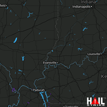 EVANSVILLE (KVWX) RADAR

