This weather event on June 15, 2025 includes:
3 states
33 counties,
12 cities,
and 81 zip codes.
There were 384 total properties that were impacted and have possible damage.
States Impacted By Hail On June 15, 2025
North Carolina
·
Virginia
·
West Virginia
Counties Impacted By Hail On June 15, 2025
Caswell, NC
·
Cleveland, NC
·
Durham, NC
·
Franklin, NC
·
Lincoln, NC
·
Montgomery, NC
·
Orange, NC
·
Stanly, NC
·
Bath, VA
·
Brunswick, VA
·
Buckingham, VA
·
Campbell, VA
·
Charlotte, VA
·
Craig, VA
·
Dinwiddie, VA
·
Floyd, VA
·
Franklin, VA
·
Giles, VA
·
Halifax, VA
·
Henry, VA
·
Highland, VA
·
Lunenburg, VA
·
Mecklenburg, VA
·
Nottoway, VA
·
Patrick, VA
·
Pittsylvania, VA
·
Prince Edward, VA
·
Pulaski, VA
·
Gilmer, WV
·
Kanawha, WV
·
Lewis, WV
·
Lincoln, WV
·
Summers, WV
Cities Impacted By Hail On June 15, 2025
Alberta, VA
·
Alum Creek, WV
·
Belwood, NC
·
Burkeville, VA
·
Carrboro, NC
·
Chapel Hill, NC
·
Hot Springs, VA
·
Louisburg, NC
·
Riverdale, VA
·
South Boston, VA
·
Tornado, WV
·
Warm Springs, VA
Zip Codes Impacted By Hail On June 15, 2025
23821
·
23824
·
23843
·
23876
·
23894
·
23901
·
23920
·
23923
·
23924
·
23927
·
23930
·
23934
·
23936
·
23938
·
23942
·
23944
·
23947
·
23958
·
23960
·
23962
·
23966
·
23967
·
23968
·
24054
·
24065
·
24067
·
24084
·
24088
·
24091
·
24092
·
24127
·
24134
·
24151
·
24184
·
24185
·
24412
·
24445
·
24458
·
24460
·
24465
·
24484
·
24487
·
24520
·
24528
·
24530
·
24531
·
24554
·
24557
·
24558
·
24563
·
24569
·
24589
·
24592
·
24910
·
25003
·
25202
·
25564
·
26321
·
26384
·
26452
·
27212
·
27217
·
27244
·
27291
·
27305
·
27311
·
27315
·
27326
·
27343
·
27371
·
27379
·
27516
·
27549
·
27701
·
27705
·
27707
·
28090
·
28127
·
28168
·
23922
·
24522
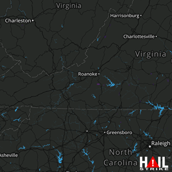 ROANOKE (KFCX) RADAR

