This weather event on June 10, 2025 includes:
1 states
27 counties,
8 cities,
and 53 zip codes.
There were 39 total properties that were impacted and have possible damage.
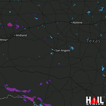 SAN ANGELO (KSJT) RADAR
States Impacted By Hail On June 10, 2025
Texas
Counties Impacted By Hail On June 10, 2025
Andrews, TX
·
Bandera, TX
·
Borden, TX
·
Coke, TX
·
Crockett, TX
·
Dawson, TX
·
Edwards, TX
·
Glasscock, TX
·
Howard, TX
·
Irion, TX
·
Kimble, TX
·
Kinney, TX
·
Martin, TX
·
Mason, TX
·
Nolan, TX
·
Pecos, TX
·
Reagan, TX
·
Real, TX
·
Schleicher, TX
·
Scurry, TX
·
Sterling, TX
·
Sutton, TX
·
Taylor, TX
·
Terrell, TX
·
Tom Green, TX
·
Uvalde, TX
·
Val Verde, TX
Cities Impacted By Hail On June 10, 2025
Andrews, TX
·
Brackettville, TX
·
Fort Clark Springs, TX
·
Gail, TX
·
Roscoe, TX
·
Sanderson, TX
·
Snyder, TX
·
Sonora, TX
Zip Codes Impacted By Hail On June 10, 2025
76820
·
76841
·
76849
·
76856
·
76869
·
76874
·
76904
·
76930
·
76935
·
76936
·
76941
·
76943
·
76945
·
76950
·
76951
·
78801
·
78832
·
78837
·
78838
·
78840
·
78851
·
78871
·
78873
·
78879
·
78880
·
78884
·
78885
·
79331
·
79511
·
79512
·
79517
·
79526
·
79527
·
79536
·
79541
·
79545
·
79549
·
79556
·
79562
·
79563
·
79602
·
79713
·
79714
·
79720
·
79735
·
79738
·
79744
·
79748
·
79749
·
79781
·
79782
·
79783
·
79848

