This weather event on June 10, 2025 includes:
2 states
26 counties,
15 cities,
and 68 zip codes.
There were 543 total properties that were impacted and have possible damage.
States Impacted By Hail On June 10, 2025
Louisiana
·
Texas
Counties Impacted By Hail On June 10, 2025
Avoyelles, LA
·
Beauregard, LA
·
De Soto, LA
·
Grant, LA
·
LaSalle, LA
·
Natchitoches, LA
·
Rapides, LA
·
Red River, LA
·
Sabine, LA
·
Vernon, LA
·
Winn, LA
·
Anderson, TX
·
Angelina, TX
·
Cherokee, TX
·
Freestone, TX
·
Gregg, TX
·
Harrison, TX
·
Houston, TX
·
Nacogdoches, TX
·
Newton, TX
·
Panola, TX
·
Rusk, TX
·
Sabine, TX
·
San Augustine, TX
·
Shelby, TX
·
Smith, TX
Cities Impacted By Hail On June 10, 2025
Alexandria, LA
·
Alto, TX
·
Coushatta, LA
·
Henderson, TX
·
Keachi, LA
·
Longstreet, LA
·
Longview, TX
·
Nacogdoches, TX
·
New London, TX
·
Powhatan, LA
·
Stanley, LA
·
Timpson, TX
·
Troup, TX
·
Whitehouse, TX
·
Winnfield, LA
Zip Codes Impacted By Hail On June 10, 2025
70653
·
70656
·
71019
·
71032
·
71046
·
71049
·
71052
·
71063
·
71303
·
71328
·
71331
·
71403
·
71409
·
71411
·
71416
·
71419
·
71424
·
71432
·
71439
·
71446
·
71447
·
71449
·
71457
·
71462
·
71469
·
71483
·
71486
·
75602
·
75603
·
75633
·
75639
·
75643
·
75652
·
75667
·
75669
·
75681
·
75684
·
75691
·
75750
·
75760
·
75766
·
75785
·
75789
·
75791
·
75801
·
75803
·
75835
·
75840
·
75844
·
75847
·
75853
·
75901
·
75925
·
75929
·
75935
·
75937
·
75946
·
75949
·
75961
·
75964
·
75972
·
75974
·
75975
·
75978
·
77612
·
75973
·
75930
·
71438
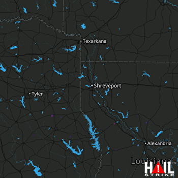 SHREVEPORT (KSHV) RADAR

