This weather event on June 9, 2025 includes:
4 states
19 counties,
20 cities,
and 56 zip codes.
There were 136 total properties that were impacted and have possible damage.
States Impacted By Hail On June 9, 2025
Illinois
·
Indiana
·
Kentucky
·
Missouri
Counties Impacted By Hail On June 9, 2025
Alexander, IL
·
Hardin, IL
·
Johnson, IL
·
Massac, IL
·
Pope, IL
·
Pulaski, IL
·
Warrick, IN
·
Ballard, KY
·
Caldwell, KY
·
Carlisle, KY
·
Henderson, KY
·
Hickman, KY
·
Livingston, KY
·
Lyon, KY
·
McCracken, KY
·
Union, KY
·
Webster, KY
·
Mississippi, MO
·
Scott, MO
Cities Impacted By Hail On June 9, 2025
Bandana, KY
·
Barlow, KY
·
Belknap, IL
·
Blodgett, MO
·
Cairo, IL
·
Commerce, MO
·
Joppa, IL
·
Karnak, IL
·
La Center, KY
·
Metropolis, IL
·
Mound City, IL
·
Mounds, IL
·
New Grand Chain, IL
·
Olive Branch, IL
·
Olmsted, IL
·
Paducah, KY
·
Pulaski, IL
·
Robards, KY
·
Smithland, KY
·
Tamms, IL
Zip Codes Impacted By Hail On June 9, 2025
42024
·
42028
·
42031
·
42035
·
42038
·
42045
·
42053
·
42056
·
42058
·
42081
·
42083
·
42086
·
42087
·
42404
·
42445
·
42452
·
42461
·
42462
·
47601
·
62908
·
62910
·
62914
·
62923
·
62931
·
62938
·
62941
·
62943
·
62947
·
62953
·
62956
·
62960
·
62962
·
62963
·
62964
·
62969
·
62970
·
62972
·
62976
·
62985
·
62988
·
62990
·
62992
·
62996
·
63736
·
63742
·
63771
·
63780
·
63801
·
63824
·
63834
·
42001
·
42003
·
42022
·
42023
·
42055
·
42406
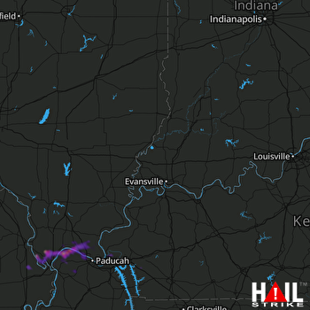 EVANSVILLE (KVWX) RADAR

