This weather event on June 7, 2025 includes:
2 states
23 counties,
21 cities,
and 76 zip codes.
There were 799 total properties that were impacted and have possible damage.
States Impacted By Hail On June 7, 2025
Kansas
·
Oklahoma
Counties Impacted By Hail On June 7, 2025
Anderson, KS
·
Chautauqua, KS
·
Coffey, KS
·
Cowley, KS
·
Franklin, KS
·
Geary, KS
·
Jackson, KS
·
Jefferson, KS
·
Kingman, KS
·
Labette, KS
·
Lyon, KS
·
Montgomery, KS
·
Morris, KS
·
Osage, KS
·
Pottawatomie, KS
·
Riley, KS
·
Shawnee, KS
·
Sumner, KS
·
Wabaunsee, KS
·
Kay, OK
·
Nowata, OK
·
Osage, OK
·
Washington, OK
Cities Impacted By Hail On June 7, 2025
Arkansas City, KS
·
Bartlett, KS
·
Caney, KS
·
Chautauqua, KS
·
Coffeyville, KS
·
Council Grove, KS
·
Dearing, KS
·
Dexter, KS
·
Edna, KS
·
Elgin, KS
·
Emporia, KS
·
Hoyt, KS
·
Manhattan, KS
·
Mayfield, KS
·
Neosho Rapids, KS
·
South Coffeyville, OK
·
Tyro, KS
·
Wann, OK
·
Waverly, KS
·
Wellington, KS
·
Winfield, KS
Zip Codes Impacted By Hail On June 7, 2025
66032
·
66078
·
66080
·
66088
·
66095
·
66401
·
66413
·
66419
·
66423
·
66432
·
66440
·
66441
·
66451
·
66502
·
66506
·
66507
·
66509
·
66510
·
66512
·
66521
·
66523
·
66524
·
66535
·
66537
·
66547
·
66549
·
66618
·
66834
·
66839
·
66846
·
66849
·
66854
·
66856
·
66864
·
66868
·
66871
·
66872
·
67004
·
67005
·
67019
·
67024
·
67031
·
67038
·
67051
·
67068
·
67103
·
67105
·
67119
·
67140
·
67142
·
67152
·
67156
·
67301
·
67330
·
67332
·
67333
·
67334
·
67336
·
67337
·
67340
·
67342
·
67347
·
67351
·
67356
·
67360
·
67361
·
67364
·
67449
·
74022
·
74056
·
74083
·
74647
·
74652
·
74072
·
67355
·
66801
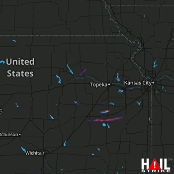 TOPEKA (KTWX) RADAR

