This weather event on May 29, 2025 includes:
1 states
28 counties,
20 cities,
and 73 zip codes.
There were 309 total properties that were impacted and have possible damage.
States Impacted By Hail On May 29, 2025
Texas
Counties Impacted By Hail On May 29, 2025
Bandera, TX
·
Bexar, TX
·
Concho, TX
·
Crockett, TX
·
Dimmit, TX
·
Edwards, TX
·
Frio, TX
·
Gillespie, TX
·
Guadalupe, TX
·
Irion, TX
·
Kerr, TX
·
Kimble, TX
·
Kinney, TX
·
La Salle, TX
·
Llano, TX
·
Mason, TX
·
Maverick, TX
·
McCulloch, TX
·
Medina, TX
·
Menard, TX
·
Real, TX
·
Schleicher, TX
·
Sutton, TX
·
Terrell, TX
·
Tom Green, TX
·
Uvalde, TX
·
Val Verde, TX
·
Zavala, TX
Cities Impacted By Hail On May 29, 2025
Batesville, TX
·
Brackettville, TX
·
Brundage, TX
·
Cibolo, TX
·
Converse, TX
·
Del Rio, TX
·
El Indio, TX
·
Fort Clark Springs, TX
·
Harper, TX
·
Kerrville, TX
·
Knippa, TX
·
Laughlin AFB, TX
·
McQueeney, TX
·
Mertzon, TX
·
Moore, TX
·
Rosita, TX
·
San Angelo, TX
·
Schertz, TX
·
St. Hedwig, TX
·
Zuehl, TX
Zip Codes Impacted By Hail On May 29, 2025
76825
·
76831
·
76837
·
76841
·
76842
·
76848
·
76849
·
76856
·
76859
·
76866
·
76874
·
76904
·
76905
·
76935
·
76936
·
76939
·
76941
·
76943
·
76955
·
78002
·
78016
·
78017
·
78024
·
78025
·
78028
·
78039
·
78052
·
78055
·
78057
·
78058
·
78059
·
78061
·
78108
·
78109
·
78123
·
78124
·
78130
·
78152
·
78154
·
78155
·
78618
·
78624
·
78631
·
78643
·
78801
·
78828
·
78829
·
78832
·
78833
·
78834
·
78837
·
78839
·
78840
·
78843
·
78851
·
78852
·
78860
·
78861
·
78870
·
78871
·
78872
·
78877
·
78880
·
78881
·
78884
·
78885
·
78886
·
79848
·
76820
·
76854
·
76887
·
76950
·
78850
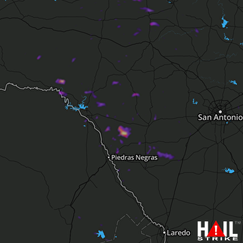 LAUGHLIN AFB (KDFX) RADAR

