This weather event on May 28, 2025 includes:
1 states
24 counties,
16 cities,
and 59 zip codes.
There were 822 total properties that were impacted and have possible damage.
States Impacted By Hail On May 28, 2025
Texas
Counties Impacted By Hail On May 28, 2025
Archer, TX
·
Baylor, TX
·
Bosque, TX
·
Brown, TX
·
Callahan, TX
·
Coleman, TX
·
Comanche, TX
·
Coryell, TX
·
Eastland, TX
·
Erath, TX
·
Hamilton, TX
·
Hill, TX
·
Hood, TX
·
Johnson, TX
·
Lampasas, TX
·
McCulloch, TX
·
Mills, TX
·
Palo Pinto, TX
·
Parker, TX
·
San Saba, TX
·
Stephens, TX
·
Tarrant, TX
·
Throckmorton, TX
·
Young, TX
Cities Impacted By Hail On May 28, 2025
Carbon, TX
·
Clifton, TX
·
Coleman, TX
·
Cresson, TX
·
Cross Plains, TX
·
De Leon, TX
·
Gordon, TX
·
Lake Brownwood, TX
·
Morgan, TX
·
Oak Trail Shores, TX
·
Olney, TX
·
Ranger, TX
·
Rising Star, TX
·
Throckmorton, TX
·
Thunderbird Bay, TX
·
Weatherford, TX
Zip Codes Impacted By Hail On May 28, 2025
76008
·
76033
·
76035
·
76048
·
76049
·
76066
·
76067
·
76087
·
76126
·
76372
·
76374
·
76380
·
76389
·
76401
·
76433
·
76435
·
76437
·
76442
·
76443
·
76444
·
76445
·
76446
·
76448
·
76453
·
76454
·
76460
·
76462
·
76463
·
76466
·
76470
·
76471
·
76472
·
76476
·
76483
·
76525
·
76528
·
76531
·
76538
·
76566
·
76627
·
76634
·
76652
·
76665
·
76671
·
76689
·
76690
·
76801
·
76823
·
76827
·
76828
·
76834
·
76857
·
76871
·
76872
·
76873
·
76878
·
79504
·
79538
·
76475
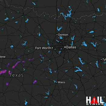 DALLAS/FTW (KFWS) RADAR

