This weather event on May 26, 2025 includes:
3 states
31 counties,
17 cities,
and 88 zip codes.
There were 14597 total properties that were impacted and have possible damage.
States Impacted By Hail On May 26, 2025
Alabama
·
Louisiana
·
Mississippi
Counties Impacted By Hail On May 26, 2025
Butler, AL
·
Choctaw, AL
·
Clarke, AL
·
Conecuh, AL
·
Crenshaw, AL
·
Dallas, AL
·
Lowndes, AL
·
Marengo, AL
·
Mobile, AL
·
Washington, AL
·
Wilcox, AL
·
Washington, LA
·
Clarke, MS
·
Copiah, MS
·
Covington, MS
·
Forrest, MS
·
Harrison, MS
·
Jackson, MS
·
Jasper, MS
·
Jones, MS
·
Lamar, MS
·
Lawrence, MS
·
Lincoln, MS
·
Pearl River, MS
·
Rankin, MS
·
Scott, MS
·
Simpson, MS
·
Smith, MS
·
Stone, MS
·
Walthall, MS
·
Wayne, MS
Cities Impacted By Hail On May 26, 2025
Big Point, MS
·
Biloxi, MS
·
Calvert, AL
·
D'Iberville, MS
·
Franklinton, LA
·
Gulfport, MS
·
Helena, MS
·
Jackson, AL
·
Latimer, MS
·
Mobile, AL
·
Mosses, AL
·
Prichard, AL
·
Puckett, MS
·
Semmes, AL
·
St. Stephens, AL
·
Theodore, AL
·
Tillmans Corner, AL
Zip Codes Impacted By Hail On May 26, 2025
36033
·
36040
·
36042
·
36049
·
36401
·
36451
·
36456
·
36482
·
36513
·
36524
·
36538
·
36541
·
36544
·
36545
·
36560
·
36569
·
36575
·
36582
·
36587
·
36606
·
36608
·
36609
·
36610
·
36612
·
36613
·
36618
·
36619
·
36688
·
36693
·
36695
·
36727
·
36732
·
36742
·
36748
·
36751
·
36752
·
36769
·
36782
·
36784
·
36785
·
36908
·
36919
·
36921
·
39042
·
39073
·
39074
·
39078
·
39082
·
39083
·
39092
·
39114
·
39117
·
39140
·
39152
·
39153
·
39168
·
39191
·
39348
·
39360
·
39366
·
39367
·
39426
·
39428
·
39439
·
39443
·
39452
·
39455
·
39470
·
39475
·
39476
·
39481
·
39501
·
39532
·
39540
·
39561
·
39562
·
39565
·
39573
·
39574
·
39577
·
39641
·
39662
·
39667
·
70427
·
70438
·
39044
·
36775
·
36037
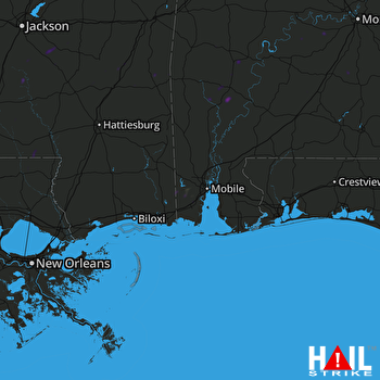 MOBILE (KMOB) RADAR

