This weather event on May 19, 2025 includes:
3 states
17 counties,
20 cities,
and 56 zip codes.
There were total properties that were impacted and have possible damage.
States Impacted By Hail On May 19, 2025
Arkansas
·
Missouri
·
Tennessee
Counties Impacted By Hail On May 19, 2025
Baxter, AR
·
Clay, AR
·
Cleburne, AR
·
Faulkner, AR
·
Izard, AR
·
Lonoke, AR
·
Pulaski, AR
·
Stone, AR
·
Van Buren, AR
·
White, AR
·
Bollinger, MO
·
Butler, MO
·
Cape Girardeau, MO
·
Oregon, MO
·
Pemiscot, MO
·
Shannon, MO
·
Lake, TN
Cities Impacted By Hail On May 19, 2025
Beebe, AR
·
Cabot, AR
·
Caruthersville, MO
·
Conway, AR
·
Enola, AR
·
Gibson, AR
·
Hayti, MO
·
Holland, AR
·
Horseshoe Bend, AR
·
Jacksonville, AR
·
Marble Hill, MO
·
Mayflower, AR
·
Melbourne, AR
·
Mountain View, AR
·
North Little Rock, AR
·
Oxford, AR
·
Scott, AR
·
Sherwood, AR
·
Tumbling Shoals, AR
·
Ward, AR
Zip Codes Impacted By Hail On May 19, 2025
38080
·
63739
·
63760
·
63764
·
63785
·
63830
·
63851
·
63954
·
65438
·
65588
·
65606
·
72007
·
72012
·
72023
·
72031
·
72032
·
72044
·
72047
·
72051
·
72076
·
72102
·
72106
·
72111
·
72116
·
72117
·
72118
·
72119
·
72120
·
72130
·
72136
·
72137
·
72142
·
72143
·
72153
·
72173
·
72176
·
72422
·
72454
·
72512
·
72513
·
72517
·
72519
·
72533
·
72536
·
72540
·
72543
·
72546
·
72555
·
72556
·
72560
·
72561
·
72565
·
72567
·
72573
·
72581
·
72585
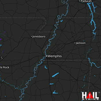 MEMPHIS (KNQA) RADAR

