This weather event on May 13, 2025 includes:
3 states
19 counties,
26 cities,
and 61 zip codes.
There were 284 total properties that were impacted and have possible damage.
States Impacted By Hail On May 13, 2025
North Carolina
·
South Carolina
·
Virginia
Counties Impacted By Hail On May 13, 2025
Columbus, NC
·
Craven, NC
·
Edgecombe, NC
·
Franklin, NC
·
Granville, NC
·
Greene, NC
·
Johnston, NC
·
Jones, NC
·
Lenoir, NC
·
Nash, NC
·
Pender, NC
·
Pitt, NC
·
Vance, NC
·
Wake, NC
·
Warren, NC
·
Wayne, NC
·
Wilson, NC
·
Horry, SC
·
Mecklenburg, VA
Cities Impacted By Hail On May 13, 2025
Archer Lodge, NC
·
Bailey, NC
·
Black Creek, NC
·
Bracey, VA
·
Castalia, NC
·
Centerville, NC
·
Clayton, NC
·
Dover, NC
·
Franklinton, NC
·
Fremont, NC
·
Goldsboro, NC
·
Henderson, NC
·
Jackson Heights, NC
·
Kinston, NC
·
Kittrell, NC
·
Momeyer, NC
·
Rolesville, NC
·
Selma, NC
·
Smithfield, NC
·
South Henderson, NC
·
Spring Hope, NC
·
Tabor City, NC
·
Wake Forest, NC
·
Wilson, NC
·
Wilson's Mills, NC
·
Youngsville, NC
Zip Codes Impacted By Hail On May 13, 2025
23917
·
23919
·
27501
·
27525
·
27526
·
27527
·
27529
·
27530
·
27536
·
27537
·
27542
·
27544
·
27549
·
27551
·
27553
·
27557
·
27565
·
27569
·
27571
·
27576
·
27577
·
27587
·
27589
·
27591
·
27592
·
27596
·
27597
·
27604
·
27616
·
27807
·
27813
·
27816
·
27822
·
27828
·
27829
·
27830
·
27856
·
27863
·
27880
·
27882
·
27883
·
27888
·
27893
·
27896
·
28425
·
28431
·
28432
·
28439
·
28463
·
28501
·
28504
·
28523
·
28551
·
28578
·
28585
·
29545
·
29569
·
29581
·
27851
·
28430
·
28526
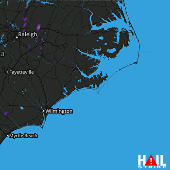 MOREHEAD CITY (KMHX) RADAR

