This weather event on May 10, 2025 includes:
1 states
23 counties,
21 cities,
and 66 zip codes.
There were 22436 total properties that were impacted and have possible damage.
States Impacted By Hail On May 10, 2025
Texas
Counties Impacted By Hail On May 10, 2025
Bell, TX
·
Blanco, TX
·
Burnet, TX
·
Caldwell, TX
·
Colorado, TX
·
Comal, TX
·
DeWitt, TX
·
Frio, TX
·
Gillespie, TX
·
Goliad, TX
·
Gonzales, TX
·
Guadalupe, TX
·
Hays, TX
·
Jackson, TX
·
Karnes, TX
·
Kendall, TX
·
Live Oak, TX
·
Medina, TX
·
Travis, TX
·
Victoria, TX
·
Wharton, TX
·
Williamson, TX
·
Wilson, TX
Cities Impacted By Hail On May 10, 2025
Canyon Lake, TX
·
Creedmoor, TX
·
Devine, TX
·
Dripping Springs, TX
·
Geronimo, TX
·
Granger, TX
·
Horseshoe Bay, TX
·
Lost Creek, TX
·
Marble Falls, TX
·
New Braunfels, TX
·
Redwood, TX
·
Rollingwood, TX
·
Salado, TX
·
San Leanna, TX
·
San Marcos, TX
·
Seguin, TX
·
Stonewall, TX
·
Sunset Valley, TX
·
Taylor, TX
·
West Lake Hills, TX
·
Wimberley, TX
Zip Codes Impacted By Hail On May 10, 2025
76511
·
76513
·
76530
·
76537
·
76571
·
76574
·
77437
·
77442
·
77905
·
77954
·
77957
·
77963
·
77976
·
78016
·
78017
·
78027
·
78059
·
78061
·
78070
·
78071
·
78113
·
78114
·
78116
·
78117
·
78118
·
78119
·
78130
·
78132
·
78155
·
78160
·
78606
·
78610
·
78619
·
78620
·
78624
·
78629
·
78635
·
78636
·
78638
·
78644
·
78648
·
78652
·
78654
·
78657
·
78661
·
78663
·
78666
·
78669
·
78671
·
78676
·
78704
·
78730
·
78731
·
78733
·
78735
·
78744
·
78745
·
78746
·
78747
·
78748
·
78749
·
78750
·
78850
·
78861
·
78884
·
78886
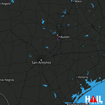 SAN ANTONIO (KEWX) RADAR

