This weather event on May 9, 2025 includes:
2 states
25 counties,
22 cities,
and 65 zip codes.
There were 58729 total properties that were impacted and have possible damage.
States Impacted By Hail On May 9, 2025
North Carolina
·
Virginia
Counties Impacted By Hail On May 9, 2025
Bertie, NC
·
Camden, NC
·
Chowan, NC
·
Currituck, NC
·
Dare, NC
·
Edgecombe, NC
·
Gates, NC
·
Greene, NC
·
Halifax, NC
·
Hertford, NC
·
Hyde, NC
·
Martin, NC
·
Nash, NC
·
Northampton, NC
·
Pasquotank, NC
·
Perquimans, NC
·
Tyrrell, NC
·
Amelia, VA
·
Brunswick, VA
·
Chesapeake, VA
·
Chesterfield, VA
·
Cumberland, VA
·
Nottoway, VA
·
Powhatan, VA
·
Virginia Beach, VA
Cities Impacted By Hail On May 9, 2025
Ahoskie, NC
·
Bellwood, VA
·
Bensley, VA
·
Brandermill, VA
·
Chesapeake, VA
·
Dortches, NC
·
Duck, NC
·
Edenton, NC
·
Kelford, NC
·
Kitty Hawk, NC
·
Meadowbrook, VA
·
Nashville, NC
·
Princeville, NC
·
Red Oak, NC
·
Rocky Mount, NC
·
Roxobel, NC
·
Southern Shores, NC
·
Tarboro, NC
·
Virginia Beach, VA
·
Walstonburg, NC
·
Williamston, NC
·
Woodlake, VA
Zip Codes Impacted By Hail On May 9, 2025
23002
·
23040
·
23083
·
23112
·
23120
·
23234
·
23237
·
23320
·
23322
·
23451
·
23453
·
23454
·
23456
·
23457
·
23461
·
23462
·
23464
·
23821
·
23824
·
23831
·
23832
·
23838
·
23868
·
27801
·
27803
·
27804
·
27805
·
27809
·
27812
·
27826
·
27828
·
27839
·
27843
·
27847
·
27849
·
27856
·
27869
·
27872
·
27874
·
27886
·
27888
·
27909
·
27910
·
27916
·
27919
·
27921
·
27922
·
27927
·
27932
·
27935
·
27938
·
27939
·
27942
·
27944
·
27946
·
27947
·
27949
·
27953
·
27964
·
27965
·
27973
·
27974
·
27983
·
27892
·
23139
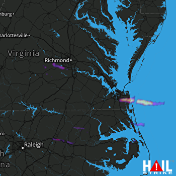 NORFOLK/RICH (KAKQ) RADAR

