This weather event on April 29, 2025 includes:
2 states
19 counties,
30 cities,
and 59 zip codes.
There were 684 total properties that were impacted and have possible damage.
States Impacted By Hail On April 29, 2025
Arkansas
·
Oklahoma
Counties Impacted By Hail On April 29, 2025
Crawford, AR
·
Franklin, AR
·
Polk, AR
·
Scott, AR
·
Washington, AR
·
Adair, OK
·
Choctaw, OK
·
Delaware, OK
·
Haskell, OK
·
Latimer, OK
·
Le Flore, OK
·
Mayes, OK
·
McCurtain, OK
·
Muskogee, OK
·
Okmulgee, OK
·
Pushmataha, OK
·
Rogers, OK
·
Sequoyah, OK
·
Wagoner, OK
Cities Impacted By Hail On April 29, 2025
Broken Arrow, OK
·
Catoosa, OK
·
Cedarville, AR
·
Cherry Tree, OK
·
Claremore, OK
·
Colcord, OK
·
Coweta, OK
·
Fair Oaks, OK
·
Fanshawe, OK
·
Fayetteville, AR
·
Fort Coffee, OK
·
Greasy, OK
·
Gregory, OK
·
Heavener, OK
·
Inola, OK
·
Le Flore, OK
·
Long, OK
·
Mena, AR
·
Rattan, OK
·
Remy, OK
·
Short, OK
·
Stilwell, OK
·
Tiawah, OK
·
Tulsa, OK
·
Tuskahoma, OK
·
Valley Park, OK
·
Van Buren, AR
·
Verdigris, OK
·
Winslow, AR
·
Zion, OK
Zip Codes Impacted By Hail On April 29, 2025
72701
·
72926
·
72932
·
72934
·
72947
·
72949
·
72950
·
72956
·
72958
·
72959
·
74014
·
74015
·
74017
·
74019
·
74036
·
74337
·
74338
·
74361
·
74422
·
74429
·
74436
·
74447
·
74467
·
74521
·
74523
·
74536
·
74549
·
74558
·
74562
·
74563
·
74571
·
74574
·
74578
·
74724
·
74735
·
74743
·
74754
·
74755
·
74756
·
74760
·
74764
·
74766
·
74931
·
74935
·
74937
·
74939
·
74941
·
74942
·
74948
·
74953
·
74954
·
74955
·
74956
·
74957
·
74959
·
74960
·
74966
·
71953
·
72952
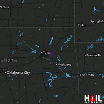 TULSA (KINX) RADAR

