This weather event on April 29, 2025 includes:
5 states
33 counties,
9 cities,
and 68 zip codes.
There were 65 total properties that were impacted and have possible damage.
States Impacted By Hail On April 29, 2025
Kentucky
·
North Carolina
·
Tennessee
·
Virginia
·
West Virginia
Counties Impacted By Hail On April 29, 2025
Adair, KY
·
Casey, KY
·
Clay, KY
·
Clinton, KY
·
Cumberland, KY
·
Estill, KY
·
Green, KY
·
Jackson, KY
·
Knott, KY
·
Laurel, KY
·
Lee, KY
·
Letcher, KY
·
Lincoln, KY
·
McCreary, KY
·
Metcalfe, KY
·
Monroe, KY
·
Perry, KY
·
Pike, KY
·
Pulaski, KY
·
Rockcastle, KY
·
Russell, KY
·
Taylor, KY
·
Wayne, KY
·
Whitley, KY
·
Wolfe, KY
·
Buncombe, NC
·
Madison, NC
·
Clay, TN
·
Cocke, TN
·
Pickett, TN
·
Sevier, TN
·
Wise, VA
·
Mingo, WV
Cities Impacted By Hail On April 29, 2025
Burkesville, KY
·
Burnside, KY
·
Campbellsville, KY
·
Eubank, KY
·
Greensburg, KY
·
Jamestown, KY
·
Jenkins, KY
·
McRoberts, KY
·
Pikeville, KY
Zip Codes Impacted By Hail On April 29, 2025
24279
·
25661
·
25670
·
25676
·
28748
·
28753
·
37722
·
37738
·
38541
·
38549
·
38551
·
40336
·
40402
·
40437
·
40442
·
40445
·
40447
·
40456
·
40460
·
40489
·
40701
·
40729
·
40737
·
40743
·
40744
·
40962
·
41301
·
41311
·
41365
·
41501
·
41517
·
41537
·
41701
·
41759
·
41773
·
41804
·
41832
·
41834
·
41835
·
42129
·
42151
·
42166
·
42167
·
42501
·
42503
·
42516
·
42518
·
42539
·
42541
·
42544
·
42566
·
42567
·
42602
·
42629
·
42633
·
42634
·
42642
·
42647
·
42653
·
42715
·
42717
·
42718
·
42728
·
42731
·
42743
·
40741
·
41563
·
41845
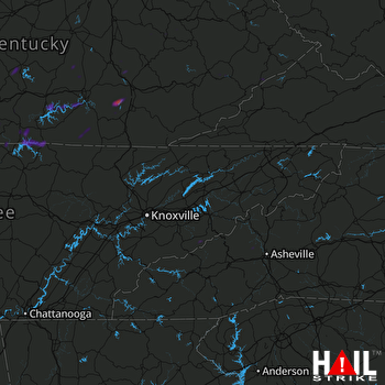 KNOXVILLE (KMRX) RADAR

