This weather event on April 28, 2025 includes:
2 states
22 counties,
29 cities,
and 74 zip codes.
There were total properties that were impacted and have possible damage.
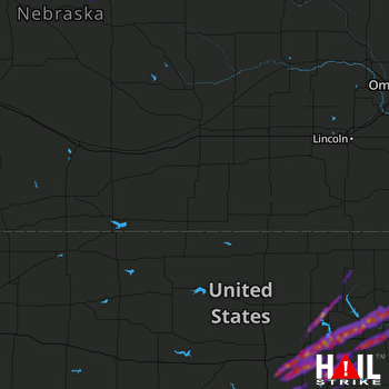 HASTINGS (KUEX) RADAR
States Impacted By Hail On April 28, 2025
Kansas
·
Nebraska
Counties Impacted By Hail On April 28, 2025
Clay, KS
·
Dickinson, KS
·
Geary, KS
·
Jackson, KS
·
Marion, KS
·
Marshall, KS
·
McPherson, KS
·
Morris, KS
·
Nemaha, KS
·
Pottawatomie, KS
·
Riley, KS
·
Saline, KS
·
Wabaunsee, KS
·
Antelope, NE
·
Garfield, NE
·
Greeley, NE
·
Holt, NE
·
Loup, NE
·
Richardson, NE
·
Rock, NE
·
Sherman, NE
·
Valley, NE
Cities Impacted By Hail On April 28, 2025
Abilene, KS
·
Blue Rapids, KS
·
Chambers, NE
·
Chapman, KS
·
Detroit, KS
·
Dwight, KS
·
Emmett, KS
·
Enterprise, KS
·
Fort Riley, KS
·
Grandview Plaza, KS
·
Gypsum, KS
·
Herington, KS
·
Home, KS
·
Junction City, KS
·
Kipp, KS
·
Latimer, KS
·
Leonardville, KS
·
Louisville, KS
·
Manhattan, KS
·
Ogden, KS
·
Orchard, NE
·
Parkerville, KS
·
Roxbury, KS
·
St. George, KS
·
Verdon, NE
·
Wakefield, KS
·
Wamego, KS
·
White City, KS
·
Woodbine, KS
Zip Codes Impacted By Hail On April 28, 2025
66401
·
66404
·
66407
·
66411
·
66422
·
66432
·
66438
·
66441
·
66449
·
66502
·
66507
·
66508
·
66514
·
66517
·
66521
·
66526
·
66531
·
66535
·
66536
·
66538
·
66547
·
66548
·
66549
·
66554
·
66834
·
66846
·
66849
·
66859
·
66872
·
66873
·
67401
·
67410
·
67416
·
67428
·
67431
·
67432
·
67438
·
67441
·
67443
·
67447
·
67448
·
67449
·
67451
·
67458
·
67470
·
67475
·
67480
·
67483
·
67487
·
67492
·
68337
·
68433
·
68442
·
68457
·
68711
·
68713
·
68720
·
68725
·
68729
·
68735
·
68742
·
68763
·
68764
·
68766
·
68773
·
68817
·
68823
·
68853
·
68859
·
68875
·
68879
·
66442
·
66503
·
66506

