This weather event on April 24, 2025 includes:
3 states
32 counties,
18 cities,
and 64 zip codes.
There were 1024 total properties that were impacted and have possible damage.
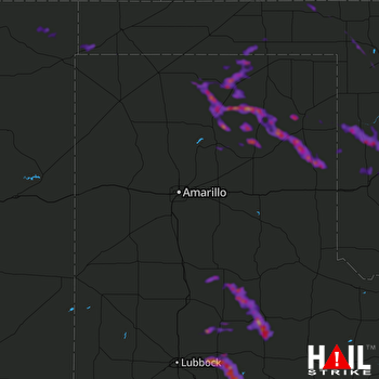 AMARILLO (KAMA) RADAR
States Impacted By Hail On April 24, 2025
New Mexico
·
Oklahoma
·
Texas
Counties Impacted By Hail On April 24, 2025
Union, NM
·
Beaver, OK
·
Beckham, OK
·
Cimarron, OK
·
Custer, OK
·
Ellis, OK
·
Harper, OK
·
Roger Mills, OK
·
Texas, OK
·
Washita, OK
·
Woodward, OK
·
Briscoe, TX
·
Carson, TX
·
Crosby, TX
·
Dallam, TX
·
Dickens, TX
·
Floyd, TX
·
Garza, TX
·
Gray, TX
·
Hale, TX
·
Hansford, TX
·
Hemphill, TX
·
Hutchinson, TX
·
Kent, TX
·
Lubbock, TX
·
Lynn, TX
·
Motley, TX
·
Ochiltree, TX
·
Roberts, TX
·
Sherman, TX
·
Swisher, TX
·
Wheeler, TX
Cities Impacted By Hail On April 24, 2025
Borger, TX
·
Canute, OK
·
Crosbyton, TX
·
Elk City, OK
·
Floydada, TX
·
Gate, OK
·
Gruver, TX
·
Knowles, OK
·
Laverne, OK
·
May, OK
·
Miami, TX
·
Morse, TX
·
Petersburg, TX
·
Ralls, TX
·
Roaring Springs, TX
·
Spearman, TX
·
Strong City, OK
·
Wheeler, TX
Zip Codes Impacted By Hail On April 24, 2025
73626
·
73628
·
73638
·
73642
·
73644
·
73647
·
73650
·
73660
·
73662
·
73801
·
73840
·
73841
·
73843
·
73844
·
73848
·
73851
·
73931
·
73933
·
73937
·
73938
·
73944
·
79003
·
79007
·
79011
·
79014
·
79022
·
79033
·
79036
·
79040
·
79052
·
79059
·
79061
·
79062
·
79065
·
79070
·
79080
·
79081
·
79083
·
79088
·
79093
·
79096
·
79220
·
79231
·
79234
·
79235
·
79241
·
79244
·
79250
·
79255
·
79256
·
79257
·
79258
·
79322
·
79343
·
79356
·
79357
·
79364
·
79370
·
79528
·
88418
·
88419
·
88424
·
73625
·
73654

