This weather event on April 23, 2025 includes:
4 states
44 counties,
62 cities,
and 194 zip codes.
There were 10093 total properties that were impacted and have possible damage.
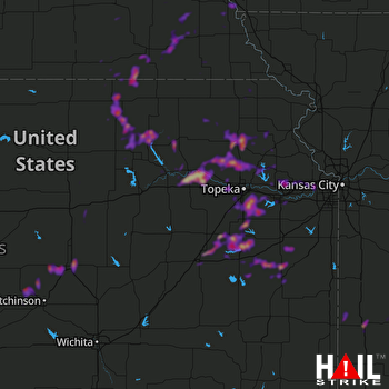 TOPEKA (KTWX) RADAR
States Impacted By Hail On April 23, 2025
Iowa
·
Kansas
·
Missouri
·
Nebraska
Counties Impacted By Hail On April 23, 2025
Fremont, IA
·
Anderson, KS
·
Atchison, KS
·
Brown, KS
·
Chase, KS
·
Clay, KS
·
Coffey, KS
·
Douglas, KS
·
Franklin, KS
·
Jackson, KS
·
Jefferson, KS
·
Johnson, KS
·
Labette, KS
·
Leavenworth, KS
·
Lyon, KS
·
Marshall, KS
·
McPherson, KS
·
Morris, KS
·
Nemaha, KS
·
Osage, KS
·
Ottawa, KS
·
Pottawatomie, KS
·
Reno, KS
·
Rice, KS
·
Riley, KS
·
Saline, KS
·
Shawnee, KS
·
Wabaunsee, KS
·
Washington, KS
·
Wyandotte, KS
·
Barton, MO
·
Bates, MO
·
Cedar, MO
·
St. Clair, MO
·
Vernon, MO
·
Cass, NE
·
Gage, NE
·
Jefferson, NE
·
Johnson, NE
·
Lancaster, NE
·
Nemaha, NE
·
Otoe, NE
·
Pawnee, NE
·
Saline, NE
Cities Impacted By Hail On April 23, 2025
Altamont, KS
·
Auburn, KS
·
Basehor, KS
·
Beatrice, NE
·
Belvue, KS
·
Bennet, NE
·
Bonner Springs, KS
·
Burr, NE
·
Carbondale, KS
·
Circleville, KS
·
Crab Orchard, NE
·
De Soto, KS
·
Diller, NE
·
Dunlap, KS
·
Edwardsville, KS
·
Effingham, KS
·
Emmett, KS
·
Emporia, KS
·
Endicott, NE
·
Garnett, KS
·
Green, KS
·
Hamlin, KS
·
Harris, KS
·
Hollenberg, KS
·
Holton, KS
·
Hoyt, KS
·
Lawrence, KS
·
Lebo, KS
·
Liberal, MO
·
Linn, KS
·
Lyndon, KS
·
Manhattan, KS
·
McPherson, KS
·
Melvern, KS
·
Nebraska City, NE
·
Nevada, MO
·
Nickerson, KS
·
Olathe, KS
·
Osage City, KS
·
Oskaloosa, KS
·
Ottawa, KS
·
Overland Park, KS
·
Ozawkie, KS
·
Randolph, KS
·
Reading, KS
·
Richards, MO
·
Richmond, KS
·
Scranton, KS
·
Shawnee, KS
·
Silver Lake, KS
·
Steele City, NE
·
St. George, KS
·
St. Marys, KS
·
Table Rock, NE
·
Tonganoxie, KS
·
Topeka, KS
·
Virginia, NE
·
Wakarusa, KS
·
Wamego, KS
·
Waverly, KS
·
Willard, KS
·
Windom, KS
Zip Codes Impacted By Hail On April 23, 2025
51648
·
64722
·
64723
·
64741
·
64744
·
64750
·
64752
·
64772
·
64778
·
64790
·
66007
·
66012
·
66023
·
66025
·
66032
·
66033
·
66044
·
66046
·
66047
·
66049
·
66050
·
66054
·
66058
·
66060
·
66062
·
66066
·
66067
·
66070
·
66073
·
66076
·
66078
·
66079
·
66080
·
66086
·
66088
·
66092
·
66093
·
66095
·
66111
·
66210
·
66213
·
66215
·
66221
·
66226
·
66401
·
66402
·
66407
·
66409
·
66411
·
66413
·
66414
·
66415
·
66417
·
66418
·
66422
·
66424
·
66425
·
66427
·
66428
·
66434
·
66436
·
66440
·
66449
·
66451
·
66502
·
66503
·
66506
·
66507
·
66510
·
66512
·
66515
·
66516
·
66520
·
66521
·
66523
·
66524
·
66526
·
66527
·
66528
·
66533
·
66534
·
66535
·
66536
·
66537
·
66539
·
66540
·
66542
·
66543
·
66546
·
66547
·
66548
·
66549
·
66550
·
66552
·
66554
·
66604
·
66605
·
66606
·
66609
·
66610
·
66611
·
66612
·
66614
·
66615
·
66618
·
66619
·
66621
·
66622
·
66801
·
66830
·
66833
·
66843
·
66846
·
66850
·
66856
·
66864
·
66868
·
66871
·
66933
·
66937
·
66944
·
66945
·
66946
·
66953
·
66955
·
66958
·
66962
·
66968
·
67330
·
67354
·
67356
·
67357
·
67401
·
67432
·
67443
·
67447
·
67448
·
67457
·
67460
·
67467
·
67470
·
67480
·
67491
·
67502
·
67510
·
67546
·
67554
·
67561
·
67579
·
68301
·
68304
·
68305
·
68310
·
68317
·
68318
·
68320
·
68324
·
68329
·
68332
·
68333
·
68341
·
68342
·
68343
·
68347
·
68349
·
68350
·
68352
·
68357
·
68377
·
68410
·
68415
·
68418
·
68430
·
68440
·
68443
·
68446
·
68447
·
68450
·
68454
·
68458
·
68465
·
68466
·
68420
·
68344
·
68323
·
66943
·
66839
·
66617
·
66509
·
66432
·
66416
·
66041
·
64762
·
51640

