This weather event on April 22, 2025 includes:
1 states
34 counties,
18 cities,
and 71 zip codes.
There were 3967 total properties that were impacted and have possible damage.
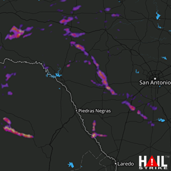 LAUGHLIN AFB (KDFX) RADAR
States Impacted By Hail On April 22, 2025
Texas
Counties Impacted By Hail On April 22, 2025
Atascosa, TX
·
Bandera, TX
·
Bexar, TX
·
Brewster, TX
·
Burnet, TX
·
Concho, TX
·
Crockett, TX
·
Dimmit, TX
·
Edwards, TX
·
Frio, TX
·
Gillespie, TX
·
Irion, TX
·
Kerr, TX
·
Kimble, TX
·
Kinney, TX
·
La Salle, TX
·
Llano, TX
·
Mason, TX
·
Maverick, TX
·
McCulloch, TX
·
McMullen, TX
·
Medina, TX
·
Menard, TX
·
Pecos, TX
·
Reagan, TX
·
Real, TX
·
Schleicher, TX
·
Sutton, TX
·
Terrell, TX
·
Tom Green, TX
·
Uvalde, TX
·
Val Verde, TX
·
Webb, TX
·
Zavala, TX
Cities Impacted By Hail On April 22, 2025
Bigfoot, TX
·
Camp Wood, TX
·
Charlotte, TX
·
Christine, TX
·
Granite Shoals, TX
·
Horseshoe Bay, TX
·
Jourdanton, TX
·
Menard, TX
·
Moore, TX
·
North Pearsall, TX
·
Ozona, TX
·
Pearsall, TX
·
Pleasanton, TX
·
Poteet, TX
·
Rocksprings, TX
·
Sanderson, TX
·
Sunrise Beach Village, TX
·
Uvalde, TX
Zip Codes Impacted By Hail On April 22, 2025
76837
·
76841
·
76848
·
76849
·
76854
·
76856
·
76859
·
76887
·
76904
·
76930
·
76932
·
76935
·
76936
·
76941
·
76943
·
76950
·
76955
·
78002
·
78003
·
78005
·
78008
·
78011
·
78012
·
78014
·
78016
·
78017
·
78019
·
78021
·
78024
·
78025
·
78026
·
78028
·
78045
·
78055
·
78056
·
78057
·
78058
·
78061
·
78064
·
78065
·
78072
·
78631
·
78639
·
78654
·
78657
·
78801
·
78802
·
78828
·
78829
·
78832
·
78833
·
78834
·
78837
·
78838
·
78840
·
78850
·
78861
·
78870
·
78873
·
78880
·
78881
·
78883
·
78884
·
78886
·
79781
·
79830
·
79848
·
79942
·
76825
·
76874
·
78643

