This weather event on April 19, 2025 includes:
1 states
27 counties,
21 cities,
and 78 zip codes.
There were 447 total properties that were impacted and have possible damage.
States Impacted By Hail On April 19, 2025
Texas
Counties Impacted By Hail On April 19, 2025
Atascosa, TX
·
Bandera, TX
·
Bexar, TX
·
Blanco, TX
·
Comal, TX
·
Concho, TX
·
Crockett, TX
·
Edwards, TX
·
Gillespie, TX
·
Irion, TX
·
Kendall, TX
·
Kerr, TX
·
Kimble, TX
·
Kinney, TX
·
Maverick, TX
·
McCulloch, TX
·
Medina, TX
·
Menard, TX
·
Pecos, TX
·
Real, TX
·
Schleicher, TX
·
Sutton, TX
·
Terrell, TX
·
Tom Green, TX
·
Uvalde, TX
·
Val Verde, TX
·
Zavala, TX
Cities Impacted By Hail On April 19, 2025
Boerne, TX
·
Brackettville, TX
·
Bulverde, TX
·
Comfort, TX
·
Cross Mountain, TX
·
Fair Oaks Ranch, TX
·
Fort Clark Springs, TX
·
Fredericksburg, TX
·
Harper, TX
·
Helotes, TX
·
Kerrville, TX
·
Kirby, TX
·
Lakehills, TX
·
Lake Medina Shores, TX
·
Mertzon, TX
·
Ozona, TX
·
Rocksprings, TX
·
Scenic Oaks, TX
·
Sonora, TX
·
Stonewall, TX
·
Timberwood Park, TX
Zip Codes Impacted By Hail On April 19, 2025
76825
·
76837
·
76841
·
76849
·
76858
·
76859
·
76866
·
76874
·
76930
·
76932
·
76935
·
76936
·
76939
·
76941
·
76943
·
76950
·
78002
·
78003
·
78006
·
78010
·
78011
·
78013
·
78015
·
78016
·
78024
·
78026
·
78028
·
78052
·
78055
·
78056
·
78058
·
78063
·
78069
·
78163
·
78214
·
78218
·
78219
·
78220
·
78221
·
78227
·
78228
·
78237
·
78239
·
78240
·
78244
·
78245
·
78249
·
78250
·
78252
·
78254
·
78255
·
78256
·
78257
·
78260
·
78624
·
78631
·
78636
·
78663
·
78671
·
78675
·
78832
·
78837
·
78839
·
78840
·
78852
·
78861
·
78871
·
78880
·
78885
·
78886
·
79744
·
79781
·
79848
·
79942
·
78873
·
78801
·
78023
·
76904
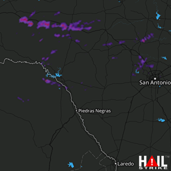 LAUGHLIN AFB (KDFX) RADAR

