This weather event on April 19, 2025 includes:
2 states
23 counties,
25 cities,
and 75 zip codes.
There were 158 total properties that were impacted and have possible damage.
States Impacted By Hail On April 19, 2025
Oklahoma
·
Texas
Counties Impacted By Hail On April 19, 2025
Bryan, OK
·
Comanche, OK
·
Cotton, OK
·
Marshall, OK
·
Tillman, OK
·
Callahan, TX
·
Clay, TX
·
Coleman, TX
·
Cooke, TX
·
Dallas, TX
·
Denton, TX
·
Eastland, TX
·
Erath, TX
·
Grayson, TX
·
Hood, TX
·
Jack, TX
·
Johnson, TX
·
Montague, TX
·
Palo Pinto, TX
·
Parker, TX
·
Stephens, TX
·
Taylor, TX
·
Wise, TX
Cities Impacted By Hail On April 19, 2025
Alvord, TX
·
Annetta North, TX
·
Baird, TX
·
Briaroaks, TX
·
Bridgeport, TX
·
Burleson, TX
·
Chico, TX
·
Cleburne, TX
·
Cross Timber, TX
·
Decatur, TX
·
Denison, TX
·
Gainesville, TX
·
Geronimo, OK
·
Hudson Oaks, TX
·
Joshua, TX
·
Lake Bridgeport, TX
·
Lindsay, TX
·
Mesquite, TX
·
Potosi, TX
·
Putnam, TX
·
Runaway Bay, TX
·
Sherman, TX
·
Sunset, TX
·
Valley View, TX
·
Weatherford, TX
Zip Codes Impacted By Hail On April 19, 2025
76087
·
76088
·
76449
·
76453
·
76454
·
76458
·
76464
·
76486
·
76487
·
76834
·
79602
·
79562
·
79541
·
79510
·
79504
·
76884
·
76476
·
76475
·
76471
·
76470
·
76469
·
76462
·
76448
·
76437
·
76435
·
76433
·
76431
·
76429
·
76426
·
76424
·
76401
·
76377
·
76357
·
76305
·
76273
·
76272
·
76270
·
76266
·
76265
·
76264
·
76263
·
76252
·
76251
·
76250
·
76245
·
76240
·
76239
·
76238
·
76234
·
76233
·
76230
·
76225
·
76078
·
76063
·
76058
·
76033
·
76031
·
76028
·
76009
·
76008
·
75228
·
75150
·
75092
·
75076
·
75021
·
75020
·
74733
·
74730
·
73572
·
73553
·
73543
·
73540
·
73528
·
73501
·
73439
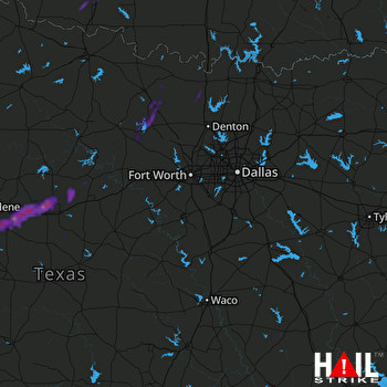 DALLAS/FTW (KFWS) RADAR

