This weather event on April 18, 2025 includes:
1 states
16 counties,
36 cities,
and 70 zip codes.
There were total properties that were impacted and have possible damage.
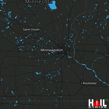 MINNEAPOLIS (KMPX) RADAR
States Impacted By Hail On April 18, 2025
Iowa
Counties Impacted By Hail On April 18, 2025
Bremer, IA
·
Butler, IA
·
Cerro Gordo, IA
·
Chickasaw, IA
·
Clay, IA
·
Fayette, IA
·
Floyd, IA
·
Franklin, IA
·
Hancock, IA
·
Humboldt, IA
·
Kossuth, IA
·
Mitchell, IA
·
Palo Alto, IA
·
Pocahontas, IA
·
Winneshiek, IA
·
Wright, IA
Cities Impacted By Hail On April 18, 2025
Alexander, IA
·
Aredale, IA
·
Bode, IA
·
Chapin, IA
·
Charles City, IA
·
Clear Lake, IA
·
Colwell, IA
·
Dougherty, IA
·
Emmetsburg, IA
·
Floyd, IA
·
Garner, IA
·
Goodell, IA
·
Greene, IA
·
Hampton, IA
·
Ionia, IA
·
Irvington, IA
·
Kanawha, IA
·
Klemme, IA
·
Latimer, IA
·
Livermore, IA
·
Lu Verne, IA
·
Marble Rock, IA
·
Meservey, IA
·
New Hampton, IA
·
Rockford, IA
·
Rockwell, IA
·
Roseville, IA
·
Rudd, IA
·
Sexton, IA
·
Sheffield, IA
·
St. Benedict, IA
·
St. Joseph, IA
·
Swaledale, IA
·
Swea City, IA
·
Thornton, IA
·
Ventura, IA
Zip Codes Impacted By Hail On April 18, 2025
50071
·
50401
·
50420
·
50421
·
50423
·
50428
·
50430
·
50433
·
50435
·
50438
·
50439
·
50441
·
50447
·
50449
·
50452
·
50457
·
50458
·
50460
·
50468
·
50469
·
50470
·
50471
·
50475
·
50477
·
50479
·
50482
·
50483
·
50511
·
50515
·
50519
·
50525
·
50527
·
50528
·
50536
·
50542
·
50545
·
50546
·
50548
·
50558
·
50560
·
50562
·
50570
·
50577
·
50581
·
50582
·
50590
·
50597
·
50603
·
50605
·
50611
·
50616
·
50619
·
50620
·
50625
·
50628
·
50630
·
50636
·
50645
·
50653
·
50658
·
50659
·
50666
·
51301
·
51333
·
51343
·
51358
·
51366
·
52144
·
52154
·
52171

