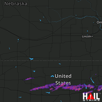
This weather event on April 17, 2025 includes:
1 states
18 counties,
26 cities,
and 61 zip codes.
There were 2911 total properties that were impacted and have possible damage.
States Impacted By Hail On April 17, 2025
Kansas
Counties Impacted By Hail On April 17, 2025
Clay, KS
·
Cloud, KS
·
Dickinson, KS
·
Ellis, KS
·
Geary, KS
·
Graham, KS
·
Lincoln, KS
·
Marshall, KS
·
Mitchell, KS
·
Morris, KS
·
Osborne, KS
·
Ottawa, KS
·
Pottawatomie, KS
·
Riley, KS
·
Rooks, KS
·
Russell, KS
·
Wabaunsee, KS
·
Washington, KS
Cities Impacted By Hail On April 17, 2025
Ada, KS
·
Alma, KS
·
Barnard, KS
·
Barnes, KS
·
Bennington, KS
·
Chapman, KS
·
Enterprise, KS
·
Fort Riley, KS
·
Herington, KS
·
Hunter, KS
·
Junction City, KS
·
Longford, KS
·
Lucas, KS
·
Luray, KS
·
Manchester, KS
·
Manhattan, KS
·
Milford, KS
·
Minneapolis, KS
·
Ogden, KS
·
Paradise, KS
·
Stockton, KS
·
Sylvan Grove, KS
·
Talmage, KS
·
Wakefield, KS
·
Waldo, KS
·
Wamego, KS
Zip Codes Impacted By Hail On April 17, 2025
66401
·
66407
·
66411
·
66427
·
66441
·
66442
·
66502
·
66503
·
66508
·
66514
·
66517
·
66520
·
66526
·
66531
·
66535
·
66547
·
66549
·
66554
·
66834
·
66849
·
66872
·
66873
·
66933
·
66943
·
67410
·
67418
·
67420
·
67422
·
67431
·
67432
·
67436
·
67441
·
67445
·
67449
·
67452
·
67455
·
67458
·
67466
·
67467
·
67473
·
67480
·
67481
·
67482
·
67484
·
67485
·
67487
·
67601
·
67625
·
67632
·
67637
·
67640
·
67648
·
67649
·
67651
·
67658
·
67663
·
67665
·
67669
·
67671
·
67673
·
67675
 HASTINGS (KUEX) RADAR

