This weather event on April 4, 2025 includes:
1 states
30 counties,
20 cities,
and 70 zip codes.
There were 12355 total properties that were impacted and have possible damage.
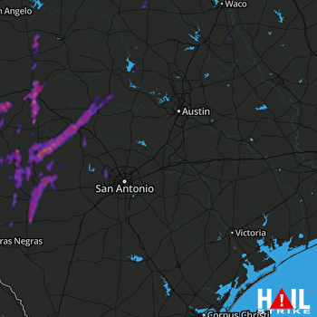 SAN ANTONIO (KEWX) RADAR
States Impacted By Hail On April 4, 2025
Texas
Counties Impacted By Hail On April 4, 2025
Bandera, TX
·
Bell, TX
·
Bexar, TX
·
Blanco, TX
·
Burnet, TX
·
Comanche, TX
·
Concho, TX
·
Coryell, TX
·
Edwards, TX
·
Falls, TX
·
Gillespie, TX
·
Hamilton, TX
·
Kerr, TX
·
Kimble, TX
·
Kinney, TX
·
Lampasas, TX
·
Limestone, TX
·
Llano, TX
·
Mason, TX
·
Maverick, TX
·
McCulloch, TX
·
Medina, TX
·
Menard, TX
·
Mills, TX
·
Real, TX
·
Robertson, TX
·
San Saba, TX
·
Sutton, TX
·
Uvalde, TX
·
Zavala, TX
Cities Impacted By Hail On April 4, 2025
Buchanan Dam, TX
·
Calvert, TX
·
Camp Wood, TX
·
Fredericksburg, TX
·
Hamilton, TX
·
Harper, TX
·
Ingram, TX
·
Junction, TX
·
Kerrville, TX
·
Kingsland, TX
·
Knippa, TX
·
Kosse, TX
·
La Pryor, TX
·
Leakey, TX
·
Lott, TX
·
Menard, TX
·
Sabinal, TX
·
Utopia, TX
·
Uvalde, TX
·
Uvalde Estates, TX
Zip Codes Impacted By Hail On April 4, 2025
76436
·
76513
·
76522
·
76525
·
76528
·
76531
·
76539
·
76550
·
76570
·
76632
·
76653
·
76656
·
76825
·
76831
·
76832
·
76837
·
76842
·
76844
·
76849
·
76854
·
76856
·
76858
·
76859
·
76869
·
76870
·
76874
·
76877
·
76887
·
76950
·
77837
·
78003
·
78010
·
78023
·
78024
·
78025
·
78028
·
78055
·
78058
·
78253
·
78254
·
78609
·
78611
·
78618
·
78624
·
78631
·
78636
·
78639
·
78643
·
78675
·
78801
·
78802
·
78828
·
78829
·
78833
·
78838
·
78850
·
78852
·
78861
·
78870
·
78872
·
78873
·
78879
·
78880
·
78881
·
78883
·
78884
·
78885
·
76455
·
78056
·
78832

