This weather event on April 2, 2025 includes:
3 states
22 counties,
21 cities,
and 64 zip codes.
There were 842 total properties that were impacted and have possible damage.
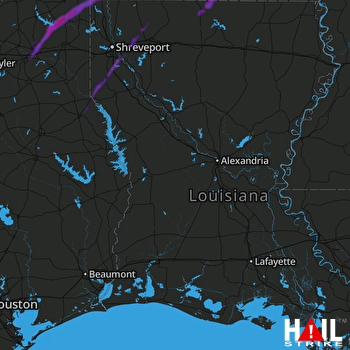 FORT POLK (KPOE) RADAR
States Impacted By Hail On April 2, 2025
Arkansas
·
Louisiana
·
Texas
Counties Impacted By Hail On April 2, 2025
Columbia, AR
·
Lafayette, AR
·
Miller, AR
·
Union, AR
·
Bienville, LA
·
Bossier, LA
·
Caddo, LA
·
Claiborne, LA
·
De Soto, LA
·
Lincoln, LA
·
Union, LA
·
Webster, LA
·
Cass, TX
·
Cherokee, TX
·
Gregg, TX
·
Harrison, TX
·
Marion, TX
·
Panola, TX
·
Rusk, TX
·
San Augustine, TX
·
Shelby, TX
·
Smith, TX
Cities Impacted By Hail On April 2, 2025
Bernice, LA
·
Bossier City, LA
·
Bryceland, LA
·
Eastwood, LA
·
Gloster, LA
·
Haughton, LA
·
Jefferson, TX
·
Joaquin, TX
·
Keachi, LA
·
Kilgore, TX
·
Lillie, LA
·
Logansport, LA
·
Longstreet, LA
·
Longview, TX
·
New London, TX
·
Pine Harbor, TX
·
Rodessa, LA
·
Shreveport, LA
·
Spearsville, LA
·
Stonewall, LA
·
White Oak, TX
Zip Codes Impacted By Hail On April 2, 2025
71008
·
71018
·
71027
·
71028
·
71030
·
71032
·
71037
·
71038
·
71040
·
71044
·
71046
·
71047
·
71049
·
71055
·
71067
·
71069
·
71072
·
71078
·
71106
·
71110
·
71112
·
71115
·
71222
·
71235
·
71256
·
71260
·
71275
·
71277
·
71730
·
71740
·
71749
·
71753
·
71765
·
71826
·
71834
·
71837
·
71845
·
71860
·
71861
·
75551
·
75555
·
75556
·
75562
·
75563
·
75565
·
75601
·
75602
·
75603
·
75604
·
75605
·
75630
·
75640
·
75650
·
75651
·
75654
·
75657
·
75662
·
75682
·
75684
·
75693
·
75789
·
75935
·
75954
·
75972

