This weather event on February 12, 2025 includes:
1 states
13 counties,
31 cities,
and 52 zip codes.
There were 17996 total properties that were impacted and have possible damage.
States Impacted By Hail On February 12, 2025
Texas
Counties Impacted By Hail On February 12, 2025
Bastrop, TX
·
Bexar, TX
·
Brazos, TX
·
Burleson, TX
·
Caldwell, TX
·
Falls, TX
·
Guadalupe, TX
·
Hays, TX
·
Lee, TX
·
McMullen, TX
·
Milam, TX
·
Travis, TX
·
Williamson, TX
Cities Impacted By Hail On February 12, 2025
Bastrop, TX
·
Bryan, TX
·
Camp Swift, TX
·
Cibolo, TX
·
Circle D-KC Estates, TX
·
College Station, TX
·
Garfield, TX
·
Geronimo, TX
·
Hudson Bend, TX
·
Kingsbury, TX
·
Kyle, TX
·
Lexington, TX
·
Lockhart, TX
·
Marion, TX
·
Marlin, TX
·
McQueeney, TX
·
Milano, TX
·
Mustang Ridge, TX
·
New Berlin, TX
·
Niederwald, TX
·
Redwood, TX
·
San Marcos, TX
·
Schertz, TX
·
Seguin, TX
·
St. Hedwig, TX
·
Taylor, TX
·
Uhland, TX
·
Volente, TX
·
Webberville, TX
·
Wyldwood, TX
·
Zuehl, TX
Zip Codes Impacted By Hail On February 12, 2025
78957
·
78948
·
78947
·
78747
·
78734
·
78719
·
78666
·
78662
·
78659
·
78656
·
78655
·
78653
·
78650
·
78645
·
78644
·
78641
·
78640
·
78638
·
78621
·
78617
·
78616
·
78613
·
78612
·
78610
·
78602
·
78263
·
78223
·
78222
·
78155
·
78154
·
78152
·
78130
·
78124
·
78123
·
78112
·
78109
·
78108
·
78101
·
78072
·
77845
·
77840
·
77836
·
77802
·
76685
·
76682
·
76661
·
76656
·
76632
·
76577
·
76574
·
76567
·
76556
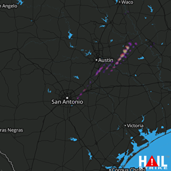 SAN ANTONIO (KEWX) RADAR

