This weather event on December 28, 2024 includes:
4 states
20 counties,
15 cities,
and 62 zip codes.
There were 2316 total properties that were impacted and have possible damage.
States Impacted By Hail On December 28, 2024
Alabama
·
Florida
·
Louisiana
·
Mississippi
Counties Impacted By Hail On December 28, 2024
Baldwin, AL
·
Choctaw, AL
·
Conecuh, AL
·
Escambia, AL
·
Mobile, AL
·
Washington, AL
·
Escambia, FL
·
St. Bernard, LA
·
St. Tammany, LA
·
Tangipahoa, LA
·
Clarke, MS
·
George, MS
·
Greene, MS
·
Jackson, MS
·
Jasper, MS
·
Lamar, MS
·
Lincoln, MS
·
Pearl River, MS
·
Pike, MS
·
Wayne, MS
Cities Impacted By Hail On December 28, 2024
Atmore, AL
·
Bay Minette, AL
·
Dauphin Island, AL
·
Fairhope, AL
·
Loxley, AL
·
Mobile, AL
·
Pachuta, MS
·
Perdido, AL
·
Point Clear, AL
·
Prichard, AL
·
Saraland, AL
·
Semmes, AL
·
Spanish Fort, AL
·
Theodore, AL
·
Tillmans Corner, AL
Zip Codes Impacted By Hail On December 28, 2024
32535
·
36401
·
36426
·
36471
·
36473
·
36502
·
36507
·
36523
·
36526
·
36527
·
36532
·
36538
·
36541
·
36544
·
36551
·
36562
·
36567
·
36568
·
36571
·
36575
·
36578
·
36582
·
36587
·
36604
·
36605
·
36606
·
36607
·
36608
·
36609
·
36612
·
36613
·
36615
·
36617
·
36618
·
36619
·
36688
·
36693
·
36695
·
36912
·
36919
·
39330
·
39348
·
39355
·
39356
·
39362
·
39426
·
39452
·
39455
·
39562
·
39565
·
39567
·
39601
·
39629
·
39652
·
39657
·
70420
·
70433
·
70471
·
70444
·
39470
·
39347
·
36475
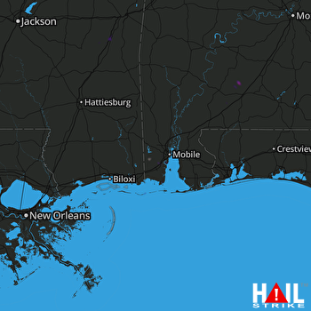 MOBILE (KMOB) RADAR

