This weather event on November 3, 2024 includes:
2 states
16 counties,
36 cities,
and 49 zip codes.
There were 320 total properties that were impacted and have possible damage.
States Impacted By Hail On November 3, 2024
Arkansas
·
Oklahoma
Counties Impacted By Hail On November 3, 2024
Sebastian, AR
·
Atoka, OK
·
Bryan, OK
·
Coal, OK
·
Haskell, OK
·
Hughes, OK
·
Johnston, OK
·
Latimer, OK
·
Le Flore, OK
·
McIntosh, OK
·
Muskogee, OK
·
Okmulgee, OK
·
Pittsburg, OK
·
Pontotoc, OK
·
Pushmataha, OK
·
Sequoyah, OK
Cities Impacted By Hail On November 3, 2024
Ada, OK
·
Arpelar, OK
·
Atoka, OK
·
Barling, AR
·
Blanco, OK
·
Bromide, OK
·
Caddo, OK
·
Caney, OK
·
Centrahoma, OK
·
Central City, AR
·
Clarita, OK
·
Coalgate, OK
·
Coleman, OK
·
Crowder, OK
·
Durant, OK
·
Fort Smith, AR
·
Gowen, OK
·
Haileyville, OK
·
Hartshorne, OK
·
Kenefic, OK
·
Kiowa, OK
·
Krebs, OK
·
Lehigh, OK
·
Liberty, OK
·
Longtown, OK
·
McAlester, OK
·
Phillips, OK
·
Pittsburg, OK
·
Remy, OK
·
Rock Island, OK
·
Stonewall, OK
·
Stringtown, OK
·
Texanna, OK
·
Tupelo, OK
·
Tushka, OK
·
Wardville, OK
Zip Codes Impacted By Hail On November 3, 2024
72916
·
72941
·
73432
·
73450
·
73460
·
73461
·
74425
·
74426
·
74430
·
74432
·
74442
·
74447
·
74455
·
74462
·
74501
·
74525
·
74528
·
74530
·
74531
·
74533
·
74534
·
74535
·
74538
·
74540
·
74546
·
74547
·
74553
·
74554
·
74556
·
74557
·
74560
·
74561
·
74565
·
74569
·
74570
·
74572
·
74576
·
74701
·
74729
·
74748
·
74820
·
74825
·
74827
·
74836
·
74932
·
74948
·
74871
·
74578
·
72936
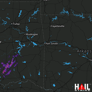 FORT SMITH (KSRX) RADAR

