This weather event on September 25, 2024 includes:
5 states
23 counties,
15 cities,
and 50 zip codes.
There were 1133 total properties that were impacted and have possible damage.
States Impacted By Hail On September 25, 2024
Kentucky
·
Ohio
·
Tennessee
·
Virginia
·
West Virginia
Counties Impacted By Hail On September 25, 2024
Bourbon, KY
·
Fayette, KY
·
Fleming, KY
·
Grant, KY
·
Jessamine, KY
·
Mason, KY
·
Nicholas, KY
·
Robertson, KY
·
Adams, OH
·
Brown, OH
·
Gallia, OH
·
Highland, OH
·
Jackson, OH
·
Pike, OH
·
Union, TN
·
Dickenson, VA
·
Lee, VA
·
Russell, VA
·
Scott, VA
·
Wise, VA
·
Kanawha, WV
·
Logan, WV
·
Roane, WV
Cities Impacted By Hail On September 25, 2024
Clinchco, VA
·
Cynthiana, OH
·
Dante, VA
·
Haysi, VA
·
Lexington-Fayette, KY
·
Man, WV
·
Mays Lick, KY
·
Maysville, KY
·
Neibert, WV
·
Paris, KY
·
Peebles, OH
·
Pennington Gap, VA
·
Sardis, KY
·
West Union, OH
·
Wise, VA
Zip Codes Impacted By Hail On September 25, 2024
24224
·
24228
·
24230
·
24237
·
24243
·
24251
·
24256
·
24265
·
24273
·
24277
·
24279
·
24283
·
24293
·
25045
·
25286
·
25632
·
25646
·
25654
·
37825
·
37866
·
37870
·
40311
·
40356
·
40361
·
40383
·
40513
·
41003
·
41010
·
41031
·
41039
·
41055
·
41056
·
41064
·
45101
·
45133
·
45144
·
45612
·
45614
·
45620
·
45624
·
45631
·
45640
·
45656
·
45658
·
45660
·
45679
·
45685
·
45693
·
45697
·
24226
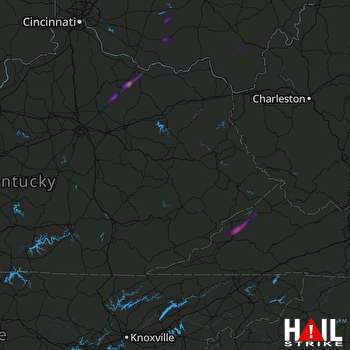 JACKSON (KJKL) RADAR

