This weather event on September 24, 2024 includes:
3 states
25 counties,
27 cities,
and 66 zip codes.
There were 519 total properties that were impacted and have possible damage.
States Impacted By Hail On September 24, 2024
Louisiana
·
Mississippi
·
Texas
Counties Impacted By Hail On September 24, 2024
Caldwell, LA
·
Grant, LA
·
Madison, LA
·
Natchitoches, LA
·
Rapides, LA
·
Richland, LA
·
Sabine, LA
·
Tensas, LA
·
Vernon, LA
·
Winn, LA
·
Claiborne, MS
·
Warren, MS
·
Angelina, TX
·
Hardin, TX
·
Jasper, TX
·
Jefferson, TX
·
Liberty, TX
·
Nacogdoches, TX
·
Newton, TX
·
Polk, TX
·
Sabine, TX
·
San Augustine, TX
·
San Jacinto, TX
·
Trinity, TX
·
Tyler, TX
Cities Impacted By Hail On September 24, 2024
Atlanta, LA
·
Banks Springs, LA
·
Big Thicket Lake Estates, TX
·
Cedar Point, TX
·
Chireno, TX
·
Clarks, LA
·
Cleveland, TX
·
Columbia, LA
·
Corrigan, TX
·
Delta, LA
·
Grayson, LA
·
Hemphill, TX
·
Hudson, TX
·
Jordan Hill, LA
·
Livingston, TX
·
Mangham, LA
·
North Cleveland, TX
·
Onalaska, TX
·
Pinewood Estates, TX
·
Redland, TX
·
San Augustine, TX
·
Simpson, LA
·
Sour Lake, TX
·
Trinity, TX
·
Vicksburg, MS
·
West Livingston, TX
·
Westwood Shores, TX
Zip Codes Impacted By Hail On September 24, 2024
39150
·
39180
·
70656
·
71259
·
71269
·
71282
·
71357
·
71403
·
71404
·
71409
·
71416
·
71417
·
71418
·
71429
·
71435
·
71438
·
71441
·
71446
·
71447
·
71449
·
71455
·
71465
·
71468
·
71469
·
71472
·
71473
·
71474
·
71479
·
71483
·
75845
·
75851
·
75862
·
75901
·
75904
·
75930
·
75935
·
75937
·
75939
·
75948
·
75956
·
75960
·
75961
·
75964
·
75968
·
75969
·
75972
·
75977
·
75979
·
77320
·
77327
·
77328
·
77331
·
77335
·
77351
·
77359
·
77360
·
77364
·
77369
·
77376
·
77378
·
77613
·
77659
·
77664
·
77713
·
71454
·
71427
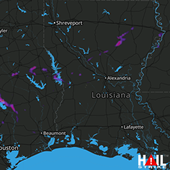 FORT POLK (KPOE) RADAR

