This weather event on September 24, 2024 includes:
2 states
29 counties,
14 cities,
and 78 zip codes.
There were 348 total properties that were impacted and have possible damage.
States Impacted By Hail On September 24, 2024
Indiana
·
Kentucky
Counties Impacted By Hail On September 24, 2024
Clark, IN
·
Floyd, IN
·
Harrison, IN
·
Perry, IN
·
Washington, IN
·
Breckinridge, KY
·
Bullitt, KY
·
Butler, KY
·
Caldwell, KY
·
Christian, KY
·
Daviess, KY
·
Franklin, KY
·
Grant, KY
·
Hancock, KY
·
Harrison, KY
·
Henry, KY
·
Hopkins, KY
·
Jefferson, KY
·
Lyon, KY
·
McLean, KY
·
Meade, KY
·
Muhlenberg, KY
·
Ohio, KY
·
Oldham, KY
·
Owen, KY
·
Scott, KY
·
Shelby, KY
·
Trigg, KY
·
Warren, KY
Cities Impacted By Hail On September 24, 2024
Cerulean, KY
·
Clarksville, IN
·
Corydon, IN
·
Doe Valley, KY
·
Eminence, KY
·
Hanson, KY
·
Jeffersontown, KY
·
Louisville, KY
·
Madisonville, KY
·
Middletown, KY
·
New Albany, IN
·
Nortonville, KY
·
Watterson Park, KY
·
Woodland Hills, KY
Zip Codes Impacted By Hail On September 24, 2024
40019
·
40023
·
40036
·
40057
·
40067
·
40104
·
40108
·
40119
·
40143
·
40144
·
40145
·
40157
·
40170
·
40176
·
40177
·
40178
·
40205
·
40213
·
40223
·
40243
·
40245
·
40272
·
40299
·
40359
·
40370
·
40601
·
41003
·
41010
·
41031
·
41097
·
42038
·
42101
·
42211
·
42215
·
42217
·
42261
·
42275
·
42301
·
42303
·
42324
·
42328
·
42337
·
42343
·
42345
·
42347
·
42348
·
42349
·
42352
·
42355
·
42361
·
42366
·
42371
·
42372
·
42376
·
42408
·
42411
·
42431
·
42436
·
42441
·
42442
·
42445
·
47110
·
47112
·
47119
·
47122
·
47129
·
47135
·
47136
·
47142
·
47150
·
47167
·
47520
·
40014
·
40065
·
40146
·
42351
·
42413
·
47117
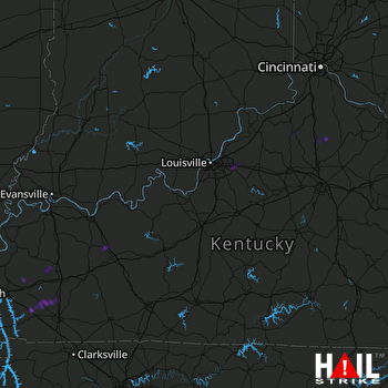 LOUISVILLE (KLVX) RADAR

