This weather event on September 17, 2024 includes:
2 states
23 counties,
12 cities,
and 73 zip codes.
There were 3542 total properties that were impacted and have possible damage.
States Impacted By Hail On September 17, 2024
New Mexico
·
Texas
Counties Impacted By Hail On September 17, 2024
Chaves, NM
·
Colfax, NM
·
Curry, NM
·
De Baca, NM
·
Eddy, NM
·
Guadalupe, NM
·
Harding, NM
·
Lincoln, NM
·
Mora, NM
·
Quay, NM
·
Roosevelt, NM
·
San Miguel, NM
·
Santa Fe, NM
·
Torrance, NM
·
Union, NM
·
Bailey, TX
·
Dallam, TX
·
Deaf Smith, TX
·
Hartley, TX
·
Lamb, TX
·
Oldham, TX
·
Parmer, TX
·
Sherman, TX
Cities Impacted By Hail On September 17, 2024
Adrian, TX
·
Dalhart, TX
·
Earth, TX
·
Grady, NM
·
Mosquero, NM
·
Muleshoe, TX
·
Nara Visa, NM
·
San Jon, NM
·
San Jose, NM
·
Soham, NM
·
Tecolote, NM
·
Vega, TX
Zip Codes Impacted By Hail On September 17, 2024
79001
·
79009
·
79018
·
79022
·
79031
·
79035
·
79044
·
79045
·
79082
·
79084
·
79092
·
79098
·
79325
·
79347
·
79371
·
87056
·
87538
·
87560
·
87562
·
87569
·
87701
·
87711
·
87712
·
87724
·
87730
·
87731
·
87733
·
87734
·
87736
·
87740
·
87743
·
87745
·
87746
·
87747
·
87752
·
87753
·
88112
·
88116
·
88118
·
88119
·
88120
·
88121
·
88124
·
88130
·
88132
·
88134
·
88135
·
88136
·
88201
·
88210
·
88316
·
88318
·
88321
·
88336
·
88343
·
88353
·
88401
·
88410
·
88411
·
88415
·
88417
·
88418
·
88422
·
88424
·
88426
·
88427
·
88430
·
88434
·
88435
·
88436
·
88421
·
88351
·
87565
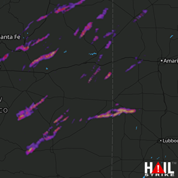 CANNON AFB (KFDX) RADAR

